Mittelbiberach geodata
Mittelbiberach (Baden-Württemberg) is a seat of a fourth-order administrative division; located in Germany in Europe/Berlin (GMT+2) time zone. With population of 3,818 people, there are 3394 cities with bigger population in this country. Compared to other cities in Germany, 94.3% of cities are located further ↑North; 53.6% of cities are located further →East and 94.1% of cities have lower elevation than Mittelbiberach. Note1
Administrative division(s):
- Level 1: Baden-Württemberg
- Level 2: Tübingen Region
- Level 3: Landkreis Biberach
- Level 4: Mittelbiberach


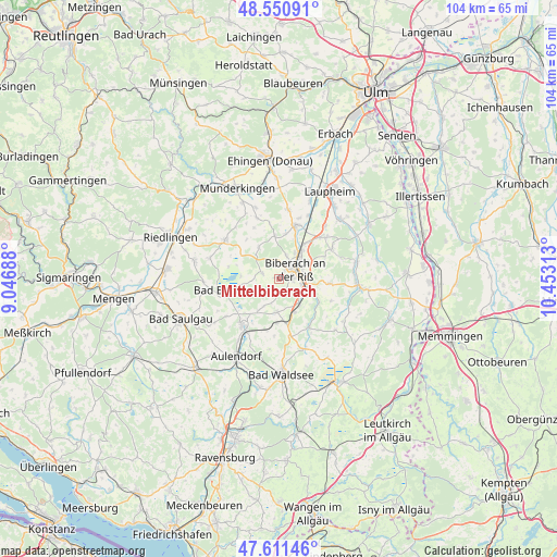
Mittelbiberach GPS coordinates[2]
48° 4' 59.988" North, 9° 45' 0" East
| Map corner | latitude | longitude |
|---|---|---|
| Upper-left | 48.55091°, | 9.04688° |
| Center: | 48.08333°, | 9.75° |
| Lower-right: | 47.61146°, | 10.45313° |
| Map W x H: | 104.5×104.5 km | = 64.9×64.9mi |
| max Lat: | 55.01917° ⇑94.3% North |
| Mittelbiberach: | 48.08333° |
| min Lat: | ⇓5.7% South 47.40724° |
| min Long | Mittelbiberach | max Long |
| 5.92978° | 9.75° | 14.98853° |
| W 46.4%⇐ | ⇒53.6% E |
Elevation
Elevation of Mittelbiberach is 577 m = 1893 ft, and this is 327.9 m = 1076 ft above average elevation for this country.
| Max E: |
1256 m = 4121 ft | 5.9% |
| Mittelbiberach | 577 m 1893 ft | |
| Avg. | 249.1 m = 817 ft | |
Min E: |
-5 m = -16 ft | 94.1% |
See also: Germany elevation on elevation.city.
Geographical zone
Mittelbiberach is located in North temperate zone (between Tropic of Cancer and the Arctic Circle). Distance of this North polar circle is 2054.8 km =1276.8 mi to North.| Distance of | km | miles | from Mittelbiberach |
|---|---|---|---|
| North Pole | 4660.7 | 2896 | to North |
| Arctic Circle | 2054.8 | 1276.8 | to North |
| Tropic Cancer | 2740.4 | 1702.8 | to South |
| Equator | 5346.4 | 3322.1 | to South |


Nearby cities:
15 places around Mittelbiberach: (largest is in red/bold)
• Alleshausen
9.8 km =6.1 mi,  283°
283°
• Attenweiler
6.7 km =4.2 mi,  326°
326°
• Bad Buchau
10.5 km =6.5 mi,  257°
257°
• Bad Schussenried
11.1 km =6.9 mi,  218°
218°
• Biberach an der Riß
3.2 km =2 mi,  69°
69°
• Eberhardzell
10.5 km =6.5 mi,  151°
151°
• Grundsheim
11.1 km =6.9 mi, 326°
• Hochdorf
7 km =4.3 mi,  156°
156°
• Ingoldingen
6.5 km =4 mi,  185°
185°
• Maselheim
11.4 km =7.1 mi,  60°
60°
• Oggelshausen
7.7 km =4.8 mi, 255°
• Seekirch
7.7 km =4.8 mi, 284°
• Tiefenbach
7.4 km =4.6 mi,  270°
270°
• Ummendorf
6.5 km =4 mi,  106°
106°
• Warthausen
6.1 km =3.8 mi,  34°
34°
Sources, notices
• [Note1] Compared only with cities in Germany existing in our database
• [Src1] Map data: © OpenStreetMap contributors (CC-BY-SA)
• [Src2] Other city data from geonames.org with taken over terms of usage.
• [Src3] Geographical zone / Annual Mean Temperature by Robert A. Rohde @ Wikipedia
