Attenweiler geodata
Attenweiler (Baden-Württemberg) is a seat of a fourth-order administrative division; located in Germany in Europe/Berlin (GMT+2) time zone. With population of 1,696 people, there are 5519 cities with bigger population in this country. Compared to other cities in Germany, 93.6% of cities are located further ↑North; 54.4% of cities are located further →East and 95.3% of cities have lower elevation than Attenweiler. Note1
Administrative division(s):
- Level 1: Baden-Württemberg
- Level 2: Tübingen Region
- Level 3: Landkreis Biberach
- Level 4: Attenweiler


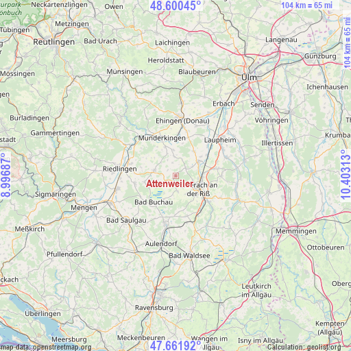
Attenweiler GPS coordinates[2]
48° 7' 59.988" North, 9° 42' 0" East
| Map corner | latitude | longitude |
|---|---|---|
| Upper-left | 48.60045°, | 8.99687° |
| Center: | 48.13333°, | 9.7° |
| Lower-right: | 47.66192°, | 10.40313° |
| Map W x H: | 104.4×104.4 km | = 64.9×64.9mi |
| max Lat: | 55.01917° ⇑93.6% North |
| Attenweiler: | 48.13333° |
| min Lat: | ⇓6.4% South 47.40724° |
| min Long | Attenweiler | max Long |
| 5.92978° | 9.7° | 14.98853° |
| W 45.6%⇐ | ⇒54.4% E |
Elevation
Elevation of Attenweiler is 605 m = 1985 ft, and this is 355.9 m = 1168 ft above average elevation for this country.
| Max E: |
1256 m = 4121 ft | 4.7% |
| Attenweiler | 605 m 1985 ft | |
| Avg. | 249.1 m = 817 ft | |
Min E: |
-5 m = -16 ft | 95.3% |
See also: Germany elevation on elevation.city.
Geographical zone
Attenweiler is located in North temperate zone (between Tropic of Cancer and the Arctic Circle). Distance of this North polar circle is 2049.2 km =1273.3 mi to North.| Distance of | km | miles | from Attenweiler |
|---|---|---|---|
| North Pole | 4655.1 | 2892.5 | to North |
| Arctic Circle | 2049.2 | 1273.3 | to North |
| Tropic Cancer | 2746 | 1706.3 | to South |
| Equator | 5351.9 | 3325.5 | to South |


Nearby cities:
15 places around Attenweiler: (largest is in red/bold)
• Alleshausen
6.7 km =4.2 mi,  240°
240°
• Bad Buchau
10.2 km =6.3 mi,  219°
219°
• Betzenweiler
10.1 km =6.3 mi,  259°
259°
• Biberach an der Riß
8.1 km =5 mi,  123°
123°
• Emerkingen
9.3 km =5.8 mi,  339°
339°
• Grundsheim
4.5 km =2.8 mi,  326°
326°
• Mittelbiberach
6.7 km =4.2 mi,  146°
146°
• Oberstadion
5.9 km =3.7 mi,  354°
354°
• Oggelshausen
8.3 km =5.2 mi,  206°
206°
• Seekirch
5.2 km =3.2 mi,  225°
225°
• Tiefenbach
6.7 km =4.2 mi, 213°
• Unterstadion
7.8 km =4.8 mi, 353°
• Unterwachingen
8.8 km =5.5 mi, 331°
• Uttenweiler
6.5 km =4 mi,  286°
286°
• Warthausen
7.3 km =4.5 mi,  94°
94°
Sources, notices
• [Note1] Compared only with cities in Germany existing in our database
• [Src1] Map data: © OpenStreetMap contributors (CC-BY-SA)
• [Src2] Other city data from geonames.org with taken over terms of usage.
• [Src3] Geographical zone / Annual Mean Temperature by Robert A. Rohde @ Wikipedia
