Oggelshausen geodata
Oggelshausen (Baden-Württemberg) is a seat of a fourth-order administrative division; located in Germany in Europe/Berlin (GMT+2) time zone. With population of 954 people, there are 7333 cities with bigger population in this country. Compared to other cities in Germany, 94.6% of cities are located further ↑North; 55.3% of cities are located further →East and 94.3% of cities have lower elevation than Oggelshausen. Note1
Administrative division(s):
- Level 1: Baden-Württemberg
- Level 2: Tübingen Region
- Level 3: Landkreis Biberach
- Level 4: Oggelshausen


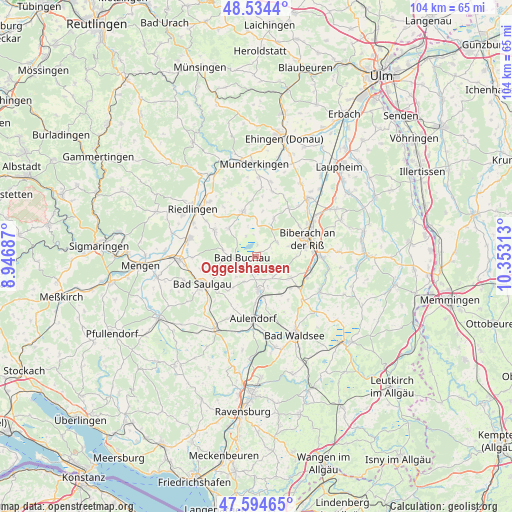
Oggelshausen GPS coordinates[2]
48° 4' 0.012" North, 9° 39' 0" East
| Map corner | latitude | longitude |
|---|---|---|
| Upper-left | 48.5344°, | 8.94687° |
| Center: | 48.06667°, | 9.65° |
| Lower-right: | 47.59465°, | 10.35313° |
| Map W x H: | 104.5×104.5 km | = 64.9×64.9mi |
| max Lat: | 55.01917° ⇑94.6% North |
| Oggelshausen: | 48.06667° |
| min Lat: | ⇓5.4% South 47.40724° |
| min Long | Oggelshausen | max Long |
| 5.92978° | 9.65° | 14.98853° |
| W 44.7%⇐ | ⇒55.3% E |
Elevation
Elevation of Oggelshausen is 581 m = 1906 ft, and this is 331.9 m = 1089 ft above average elevation for this country.
| Max E: |
1256 m = 4121 ft | 5.7% |
| Oggelshausen | 581 m 1906 ft | |
| Avg. | 249.1 m = 817 ft | |
Min E: |
-5 m = -16 ft | 94.3% |
See also: Germany elevation on elevation.city.
Geographical zone
Oggelshausen is located in North temperate zone (between Tropic of Cancer and the Arctic Circle). Distance of this North polar circle is 2056.7 km =1278 mi to North.| Distance of | km | miles | from Oggelshausen |
|---|---|---|---|
| North Pole | 4662.5 | 2897.1 | to North |
| Arctic Circle | 2056.7 | 1278 | to North |
| Tropic Cancer | 2738.6 | 1701.7 | to South |
| Equator | 5344.5 | 3320.9 | to South |


Nearby cities:
15 places around Oggelshausen: (largest is in red/bold)
• Alleshausen
4.6 km =2.9 mi,  332°
332°
• Allmannsweiler
6 km =3.7 mi,  224°
224°
• Attenweiler
8.3 km =5.2 mi,  26°
26°
• Bad Buchau
2.8 km =1.7 mi,  260°
260°
• Bad Schussenried
6.9 km =4.3 mi,  175°
175°
• Betzenweiler
8.3 km =5.2 mi,  311°
311°
• Biberach an der Riß
10.9 km =6.8 mi,  74°
74°
• Dürmentingen
10.3 km =6.4 mi,  302°
302°
• Dürnau
7.1 km =4.4 mi, 264°
• Ingoldingen
8.2 km =5.1 mi,  123°
123°
• Kanzach
6.9 km =4.3 mi,  280°
280°
• Mittelbiberach
7.7 km =4.8 mi,  75°
75°
• Seekirch
3.7 km =2.3 mi,  0°
0°
• Tiefenbach
1.9 km =1.2 mi, 0°
• Uttenweiler
9.6 km =6 mi,  345°
345°
Sources, notices
• [Note1] Compared only with cities in Germany existing in our database
• [Src1] Map data: © OpenStreetMap contributors (CC-BY-SA)
• [Src2] Other city data from geonames.org with taken over terms of usage.
• [Src3] Geographical zone / Annual Mean Temperature by Robert A. Rohde @ Wikipedia
