Minden geodata
Minden (North Rhine-Westphalia) is a seat of a third-order administrative division; located in Germany in Europe/Berlin (GMT+2) time zone. With population of 82,879 people, there are 118 cities with bigger population in this country. Compared to other cities in Germany, 75.1% of cities are located further ↓South; 66.5% of cities are located further →East and 76.1% of cities have higher elevation than Minden. Note1
Administrative division(s):
- Level 1: North Rhine-Westphalia
- Level 2: Regierungsbezirk Detmold
- Level 3: Kreis Minden-Lübbecke
- Level 4: Minden


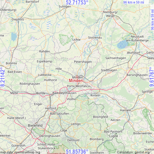
Minden GPS coordinates[2]
52° 17' 22.308" North, 8° 54' 52.38" East
| Map corner | latitude | longitude |
|---|---|---|
| Upper-left | 52.71753°, | 8.21142° |
| Center: | 52.28953°, | 8.91455° |
| Lower-right: | 51.85736°, | 9.61767° |
| Map W x H: | 95.6×95.6 km | = 59.4×59.4mi |
| max Lat: | 55.01917° ⇑24.9% North |
| Minden: | 52.28953° |
| min Lat: | ⇓75.1% South 47.40724° |
| min Long | Minden | max Long |
| 5.92978° | 8.91455° | 14.98853° |
| W 33.5%⇐ | ⇒66.5% E |
Elevation
Elevation of Minden is 59 m = 194 ft, and this is 190.1 m = 624 ft below average elevation for this country.
| Max E: |
1256 m = 4121 ft | 76.1% |
| Avg. | 249.1 m = 817 ft | |
| Minden | 59 m = 194 ft | |
Min E: |
-5 m = -16 ft | 23.9% |
See also: Minden elevation on elevation.city.
Geographical zone
Minden is located in North temperate zone (between Tropic of Cancer and the Arctic Circle). Distance of this North polar circle is 1587.1 km =986.2 mi to North.| Distance of | km | miles | from Minden |
|---|---|---|---|
| North Pole | 4193 | 2605.4 | to North |
| Arctic Circle | 1587.1 | 986.2 | to North |
| Tropic Cancer | 3208.1 | 1993.4 | to South |
| Equator | 5814.1 | 3612.7 | to South |


Nearby cities:
15 places around Minden: (largest is in red/bold)
• Ahnsen
13.3 km =8.3 mi,  107°
107°
• Bad Eilsen
13.6 km =8.5 mi, 112°
• Bad Oeynhausen
11.9 km =7.4 mi,  219°
219°
• Bückeburg
9.7 km =6 mi, 109°
• Halle
14.8 km =9.2 mi,  1°
1°
• Heeßen
13.9 km =8.6 mi,  117°
117°
• Helpsen
14 km =8.7 mi,  80°
80°
• Hespe
13.9 km =8.6 mi,  71°
71°
• Hille
12.2 km =7.6 mi,  293°
293°
• Luhden
14.1 km =8.8 mi, 120°
• Obernkirchen
14.7 km =9.1 mi,  97°
97°
• Petershagen
10.1 km =6.3 mi,  19°
19°
• Porta Westfalica
6.7 km =4.2 mi,  179°
179°
• Seggebruch
12.3 km =7.6 mi, 84°
• Vlotho
14.3 km =8.9 mi,  195°
195°
Sources, notices
• [Note1] Compared only with cities in Germany existing in our database
• [Src1] Map data: © OpenStreetMap contributors (CC-BY-SA)
• [Src2] Other city data from geonames.org with taken over terms of usage.
• [Src3] Geographical zone / Annual Mean Temperature by Robert A. Rohde @ Wikipedia
