Miesitz geodata
Miesitz (Thuringia) is a seat of a fourth-order administrative division; located in Germany in Europe/Berlin (GMT+2) time zone. With population of 303 people, there are 10040 cities with bigger population in this country. Compared to other cities in Germany, 52.8% of cities are located further ↓South; 79.3% of cities are located further ←West and 69.3% of cities have lower elevation than Miesitz. Note1


Miesitz GPS coordinates[2]
50° 43' 59.988" North, 11° 49' 59.988" East
| Map corner | latitude | longitude |
|---|---|---|
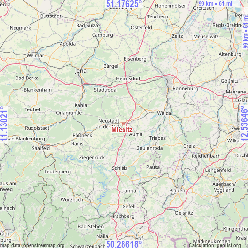
| Upper-left | 51.17625°, | 11.13021° |
| Center: | 50.73333°, | 11.83333° |
| Lower-right: | 50.28618°, | 12.53646° |
| Map W x H: | 99×99 km | = 61.5×61.5mi |
| max Lat: | 55.01917° ⇑47.2% North |
| Miesitz: | 50.73333° |
| min Lat: | ⇓52.8% South 47.40724° |
| min Long | Miesitz | max Long |
| 5.92978° | 11.83333° | 14.98853° |
| W 79.3%⇐ | ⇒20.7% E |
Elevation
Elevation of Miesitz is 353 m = 1158 ft, and this is 103.9 m = 341 ft above average elevation for this country.
| Max E: |
1256 m = 4121 ft | 30.7% |
| Miesitz | 353 m 1158 ft | |
| Avg. | 249.1 m = 817 ft | |
Min E: |
-5 m = -16 ft | 69.3% |
See also: Germany elevation on elevation.city.
Geographical zone
Miesitz is located in North temperate zone (between Tropic of Cancer and the Arctic Circle). Distance of this North polar circle is 1760.2 km =1093.7 mi to North.| Distance of | km | miles | from Miesitz |
|---|---|---|---|
| North Pole | 4366 | 2712.9 | to North |
| Arctic Circle | 1760.2 | 1093.7 | to North |
| Tropic Cancer | 3035.1 | 1885.9 | to South |
| Equator | 5641 | 3505.2 | to South |


Nearby cities:
15 places around Miesitz: (largest is in red/bold)
• Auma
5.9 km =3.7 mi,  128°
128°
• Chursdorf
7.5 km =4.7 mi,  170°
170°
• Dreitzsch
2.3 km =1.4 mi,  270°
270°
• Geroda
6 km =3.7 mi,  51°
51°
• Kospoda
6.2 km =3.9 mi,  252°
252°
• Lemnitz
1.3 km =0.8 mi,  180°
180°
• Mittelpöllnitz
6.1 km =3.8 mi,  72°
72°
• Moßbach
5.7 km =3.5 mi,  191°
191°
• Neustadt an der Orla
6.1 km =3.8 mi, 273°
• Reinsdorf
6 km =3.7 mi, 168°
• Renthendorf
7.4 km =4.6 mi,  7°
7°
• Rosendorf
5.1 km =3.2 mi,  316°
316°
• Schmieritz
3 km =1.9 mi,  231°
231°
• Triptis
2.6 km =1.6 mi,  84°
84°
• Tömmelsdorf
3 km =1.9 mi, 128°
Sources, notices
• [Note1] Compared only with cities in Germany existing in our database
• [Src1] Map data: © OpenStreetMap contributors (CC-BY-SA)
• [Src2] Other city data from geonames.org with taken over terms of usage.
• [Src3] Geographical zone / Annual Mean Temperature by Robert A. Rohde @ Wikipedia
