Mauer geodata
Mauer (Baden-Württemberg) is a seat of a fourth-order administrative division; located in Germany in Europe/Berlin (GMT+2) time zone. With population of 3,498 people, there are 3617 cities with bigger population in this country. Compared to other cities in Germany, 78.1% of cities are located further ↑North; 67.9% of cities are located further →East and 61.6% of cities have higher elevation than Mauer. Note1
Administrative division(s):
- Level 1: Baden-Württemberg
- Level 2: Karlsruhe Region
- Level 3: Rhein-Neckar-Kreis
- Level 4: Mauer


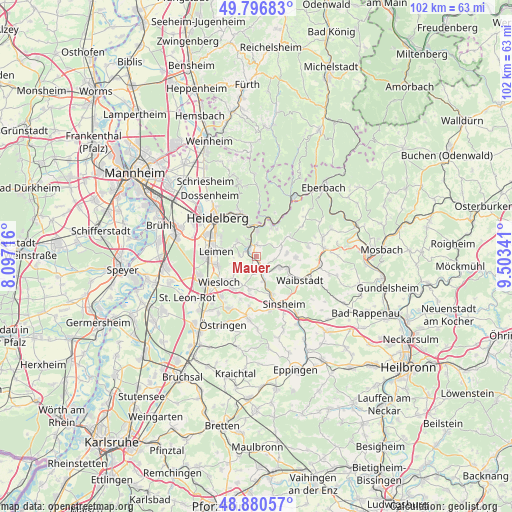
Mauer GPS coordinates[2]
49° 20' 26.988" North, 8° 48' 1.008" East
| Map corner | latitude | longitude |
|---|---|---|
| Upper-left | 49.79683°, | 8.09716° |
| Center: | 49.34083°, | 8.80028° |
| Lower-right: | 48.88057°, | 9.50341° |
| Map W x H: | 101.9×101.9 km | = 63.3×63.3mi |
| max Lat: | 55.01917° ⇑78.1% North |
| Mauer: | 49.34083° |
| min Lat: | ⇓21.9% South 47.40724° |
| min Long | Mauer | max Long |
| 5.92978° | 8.80028° | 14.98853° |
| W 32.1%⇐ | ⇒67.9% E |
Elevation
Elevation of Mauer is 141 m = 463 ft, and this is 108.1 m = 355 ft below average elevation for this country.
| Max E: |
1256 m = 4121 ft | 61.6% |
| Avg. | 249.1 m = 817 ft | |
| Mauer | 141 m = 463 ft | |
Min E: |
-5 m = -16 ft | 38.4% |
See also: Germany elevation on elevation.city.
Geographical zone
Mauer is located in North temperate zone (between Tropic of Cancer and the Arctic Circle). Distance of this North polar circle is 1915 km =1189.9 mi to North.| Distance of | km | miles | from Mauer |
|---|---|---|---|
| North Pole | 4520.9 | 2809.2 | to North |
| Arctic Circle | 1915 | 1189.9 | to North |
| Tropic Cancer | 2880.3 | 1789.7 | to South |
| Equator | 5486.2 | 3409 | to South |


Nearby cities:
15 places around Mauer: (largest is in red/bold)
• Bammental
2.3 km =1.4 mi,  318°
318°
• Dielheim
7.7 km =4.8 mi,  215°
215°
• Epfenbach
7.8 km =4.8 mi,  91°
91°
• Eschelbronn
5.3 km =3.3 mi,  116°
116°
• Gaiberg
4.6 km =2.9 mi,  307°
307°
• Horrenberg
6.9 km =4.3 mi,  191°
191°
• Lobbach
7.5 km =4.7 mi,  59°
59°
• Meckesheim
2.5 km =1.6 mi,  146°
146°
• Neckargemünd
5.4 km =3.4 mi,  356°
356°
• Neckarsteinach
8 km =5 mi,  22°
22°
• Neidenstein
6.7 km =4.2 mi,  113°
113°
• Nußloch
7.8 km =4.8 mi,  256°
256°
• Spechbach
6 km =3.7 mi,  84°
84°
• Wiesenbach
2.3 km =1.4 mi,  6°
6°
• Zuzenhausen
5.2 km =3.2 mi,  161°
161°
Sources, notices
• [Note1] Compared only with cities in Germany existing in our database
• [Src1] Map data: © OpenStreetMap contributors (CC-BY-SA)
• [Src2] Other city data from geonames.org with taken over terms of usage.
• [Src3] Geographical zone / Annual Mean Temperature by Robert A. Rohde @ Wikipedia
