Horrenberg geodata
Horrenberg (Baden-Württemberg) is a section of populated place; located in Germany in Europe/Berlin (GMT+2) time zone. With population of 1,778 people, there are 5381 cities with bigger population in this country. Compared to other cities in Germany, 79% of cities are located further ↑North; 68.2% of cities are located further →East and 59.6% of cities have higher elevation than Horrenberg. Note1
Administrative division(s):
- Level 1: Baden-Württemberg
- Level 2: Karlsruhe Region
- Level 3: Rhein-Neckar-Kreis
- Level 4: Dielheim


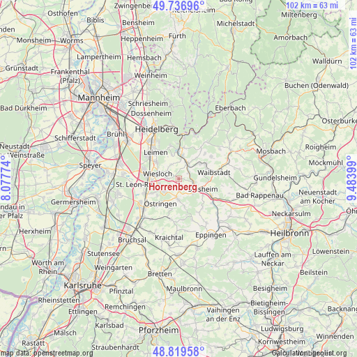
Horrenberg GPS coordinates[2]
49° 16' 49.44" North, 8° 46' 51.132" East
| Map corner | latitude | longitude |
|---|---|---|
| Upper-left | 49.73696°, | 8.07774° |
| Center: | 49.2804°, | 8.78087° |
| Lower-right: | 48.81958°, | 9.48399° |
| Map W x H: | 102×102 km | = 63.4×63.4mi |
| max Lat: | 55.01917° ⇑79% North |
| Horrenberg: | 49.2804° |
| min Lat: | ⇓21% South 47.40724° |
| min Long | Horrenberg | max Long |
| 5.92978° | 8.78087° | 14.98853° |
| W 31.8%⇐ | ⇒68.2% E |
Elevation
Elevation of Horrenberg is 156 m = 512 ft, and this is 93.1 m = 305 ft below average elevation for this country.
| Max E: |
1256 m = 4121 ft | 59.6% |
| Avg. | 249.1 m = 817 ft | |
| Horrenberg | 156 m = 512 ft | |
Min E: |
-5 m = -16 ft | 40.4% |
See also: Germany elevation on elevation.city.
Geographical zone
Horrenberg is located in North temperate zone (between Tropic of Cancer and the Arctic Circle). Distance of this North polar circle is 1921.7 km =1194.1 mi to North.| Distance of | km | miles | from Horrenberg |
|---|---|---|---|
| North Pole | 4527.6 | 2813.3 | to North |
| Arctic Circle | 1921.7 | 1194.1 | to North |
| Tropic Cancer | 2873.5 | 1785.5 | to South |
| Equator | 5479.5 | 3404.8 | to South |


Nearby cities:
15 places around Horrenberg: (largest is in red/bold)
• Balzfeld
1.4 km =0.9 mi,  154°
154°
• Bammental
8.4 km =5.2 mi,  359°
359°
• Dielheim
3.1 km =1.9 mi,  277°
277°
• Eschelbronn
7.5 km =4.7 mi,  54°
54°
• Malsch
8 km =5 mi,  242°
242°
• Mauer
6.9 km =4.3 mi,  11°
11°
• Meckesheim
5.4 km =3.4 mi,  31°
31°
• Mühlhausen
5.3 km =3.3 mi,  228°
228°
• Neidenstein
8.5 km =5.3 mi,  61°
61°
• Nußloch
7.9 km =4.9 mi,  308°
308°
• Rauenberg
5.7 km =3.5 mi,  257°
257°
• Sinsheim
7.7 km =4.8 mi,  113°
113°
• Wiesloch
6.2 km =3.9 mi,  285°
285°
• Zuzenhausen
3.5 km =2.2 mi, 59°
• Östringen
8.5 km =5.3 mi,  216°
216°
Sources, notices
• [Note1] Compared only with cities in Germany existing in our database
• [Src1] Map data: © OpenStreetMap contributors (CC-BY-SA)
• [Src2] Other city data from geonames.org with taken over terms of usage.
• [Src3] Geographical zone / Annual Mean Temperature by Robert A. Rohde @ Wikipedia
