Mörsdorf geodata
Mörsdorf (Rheinland-Pfalz) is a seat of a fourth-order administrative division; located in Germany in Europe/Berlin (GMT+2) time zone. With population of 699 people, there are 8319 cities with bigger population in this country. Compared to other cities in Germany, 61.4% of cities are located further ↑North; 89.3% of cities are located further →East and 67.6% of cities have lower elevation than Mörsdorf. Note1
Administrative division(s):
- Level 1: Rheinland-Pfalz
- Level 3: Rhein-Hunsrück-Kreis
- Level 4: Mörsdorf


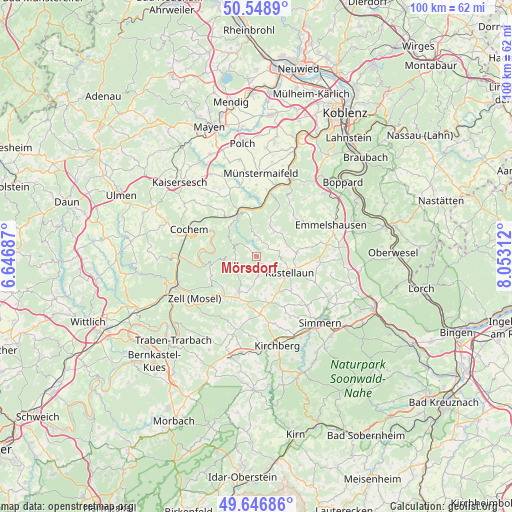
Mörsdorf GPS coordinates[2]
50° 6' 0" North, 7° 21' 0" East
| Map corner | latitude | longitude |
|---|---|---|
| Upper-left | 50.5489°, | 6.64687° |
| Center: | 50.1°, | 7.35° |
| Lower-right: | 49.64686°, | 8.05312° |
| Map W x H: | 100.3×100.3 km | = 62.3×62.3mi |
| max Lat: | 55.01917° ⇑61.4% North |
| Mörsdorf: | 50.1° |
| min Lat: | ⇓38.6% South 47.40724° |
| min Long | Mörsdorf | max Long |
| 5.92978° | 7.35° | 14.98853° |
| W 10.7%⇐ | ⇒89.3% E |
Elevation
Elevation of Mörsdorf is 340 m = 1115 ft, and this is 90.9 m = 298 ft above average elevation for this country.
| Max E: |
1256 m = 4121 ft | 32.4% |
| Mörsdorf | 340 m 1115 ft | |
| Avg. | 249.1 m = 817 ft | |
Min E: |
-5 m = -16 ft | 67.6% |
See also: Germany elevation on elevation.city.
Geographical zone
Mörsdorf is located in North temperate zone (between Tropic of Cancer and the Arctic Circle). Distance of this North polar circle is 1830.6 km =1137.5 mi to North.| Distance of | km | miles | from Mörsdorf |
|---|---|---|---|
| North Pole | 4436.5 | 2756.7 | to North |
| Arctic Circle | 1830.6 | 1137.5 | to North |
| Tropic Cancer | 2964.7 | 1842.2 | to South |
| Equator | 5570.6 | 3461.4 | to South |


Nearby cities:
15 places around Mörsdorf: (largest is in red/bold)
• Altstrimmig
3.6 km =2.2 mi,  270°
270°
• Bell
6.3 km =3.9 mi,  132°
132°
• Buch
3.9 km =2.4 mi, 133°
• Dommershausen
6.6 km =4.1 mi,  32°
32°
• Hesweiler
7.3 km =4.5 mi,  220°
220°
• Korweiler
4.8 km =3 mi,  90°
90°
• Lahr
3 km =1.9 mi,  21°
21°
• Lieg
3.7 km =2.3 mi,  0°
0°
• Liesenich
5.1 km =3.2 mi,  248°
248°
• Mastershausen
3.7 km =2.3 mi,  180°
180°
• Mittelstrimmig
5.1 km =3.2 mi, 248°
• Reidenhausen
6 km =3.7 mi,  203°
203°
• Sosberg
2.2 km =1.4 mi,  212°
212°
• Uhler
6.2 km =3.9 mi,  107°
107°
• Zilshausen
3 km =1.9 mi,  52°
52°
Sources, notices
• [Note1] Compared only with cities in Germany existing in our database
• [Src1] Map data: © OpenStreetMap contributors (CC-BY-SA)
• [Src2] Other city data from geonames.org with taken over terms of usage.
• [Src3] Geographical zone / Annual Mean Temperature by Robert A. Rohde @ Wikipedia
