Buch geodata
Buch (Rheinland-Pfalz) is a seat of a fourth-order administrative division; located in Germany in Europe/Berlin (GMT+2) time zone. With population of 943 people, there are 7371 cities with bigger population in this country. Compared to other cities in Germany, 61.9% of cities are located further ↑North; 88.7% of cities are located further →East and 76.8% of cities have lower elevation than Buch. Note1


Buch GPS coordinates[2]
50° 4' 33.924" North, 7° 23' 21.228" East
| Map corner | latitude | longitude |
|---|---|---|
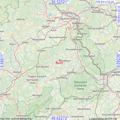
| Upper-left | 50.52521°, | 6.68611° |
| Center: | 50.07609°, | 7.38923° |
| Lower-right: | 49.62272°, | 8.09236° |
| Map W x H: | 100.3×100.3 km | = 62.3×62.3mi |
| max Lat: | 55.01917° ⇑61.9% North |
| Buch: | 50.07609° |
| min Lat: | ⇓38.1% South 47.40724° |
| min Long | Buch | max Long |
| 5.92978° | 7.38923° | 14.98853° |
| W 11.3%⇐ | ⇒88.7% E |
Elevation
Elevation of Buch is 411 m = 1348 ft, and this is 161.9 m = 531 ft above average elevation for this country.
| Max E: |
1256 m = 4121 ft | 23.2% |
| Buch | 411 m 1348 ft | |
| Avg. | 249.1 m = 817 ft | |
Min E: |
-5 m = -16 ft | 76.8% |
See also: Germany elevation on elevation.city.
Geographical zone
Buch is located in North temperate zone (between Tropic of Cancer and the Arctic Circle). Distance of this North polar circle is 1833.2 km =1139.1 mi to North.| Distance of | km | miles | from Buch |
|---|---|---|---|
| North Pole | 4439.1 | 2758.3 | to North |
| Arctic Circle | 1833.2 | 1139.1 | to North |
| Tropic Cancer | 2962 | 1840.5 | to South |
| Equator | 5567.9 | 3459.7 | to South |


Nearby cities:
15 places around Buch: (largest is in red/bold)
• Bell
2.5 km =1.6 mi,  131°
131°
• Beltheim
6.2 km =3.9 mi,  57°
57°
• Haserich
6.2 km =3.9 mi,  220°
220°
• Hasselbach
6.4 km =4 mi,  137°
137°
• Kastellaun
3.8 km =2.4 mi,  101°
101°
• Korweiler
3.3 km =2.1 mi,  36°
36°
• Lahr
5.7 km =3.5 mi,  342°
342°
• Mastershausen
3 km =1.9 mi,  249°
249°
• Mörsdorf
3.9 km =2.4 mi,  313°
313°
• Reidenhausen
5.9 km =3.7 mi,  240°
240°
• Roth
4.4 km =2.7 mi,  79°
79°
• Sosberg
4.1 km =2.5 mi,  281°
281°
• Spesenroth
5.2 km =3.2 mi,  123°
123°
• Uhler
3.2 km =2 mi, 75°
• Zilshausen
4.5 km =2.8 mi,  354°
354°
Sources, notices
• [Note1] Compared only with cities in Germany existing in our database
• [Src1] Map data: © OpenStreetMap contributors (CC-BY-SA)
• [Src2] Other city data from geonames.org with taken over terms of usage.
• [Src3] Geographical zone / Annual Mean Temperature by Robert A. Rohde @ Wikipedia
