Malchow geodata
Malchow (Mecklenburg-Vorpommern) is a populated place; located in Germany in Europe/Berlin (GMT+2) time zone. With population of 7,384 people, there are 2095 cities with bigger population in this country. Compared to other cities in Germany, 85.2% of cities are located further ↓South; 87.2% of cities are located further ←West and 72.1% of cities have higher elevation than Malchow. Note1
Administrative division(s):
- Level 1: Mecklenburg-Vorpommern
- Level 3: Mecklenburgische Seenplatte
- Level 4: Malchow


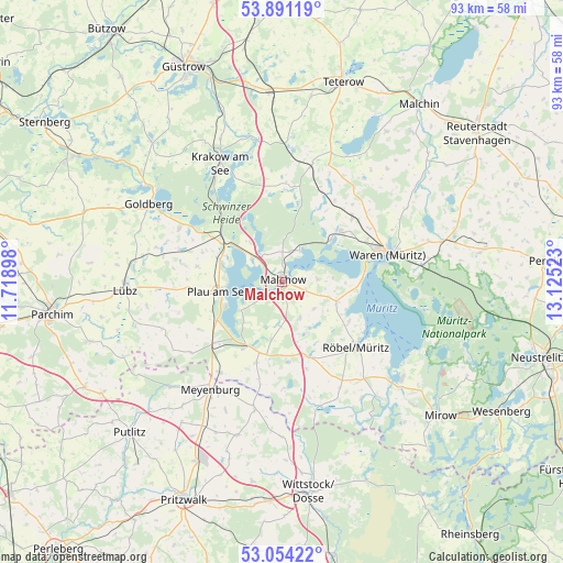
Malchow GPS coordinates[2]
53° 28' 29.172" North, 12° 25' 19.56" East
| Map corner | latitude | longitude |
|---|---|---|
| Upper-left | 53.89119°, | 11.71898° |
| Center: | 53.47477°, | 12.4221° |
| Lower-right: | 53.05422°, | 13.12523° |
| Map W x H: | 93.1×93.1 km | = 57.8×57.8mi |
| max Lat: | 55.01917° ⇑14.8% North |
| Malchow: | 53.47477° |
| min Lat: | ⇓85.2% South 47.40724° |
| min Long | Malchow | max Long |
| 5.92978° | 12.4221° | 14.98853° |
| W 87.2%⇐ | ⇒12.8% E |
Elevation
Elevation of Malchow is 77 m = 253 ft, and this is 172.1 m = 565 ft below average elevation for this country.
| Max E: |
1256 m = 4121 ft | 72.1% |
| Avg. | 249.1 m = 817 ft | |
| Malchow | 77 m = 253 ft | |
Min E: |
-5 m = -16 ft | 27.9% |
See also: Germany elevation on elevation.city.
Geographical zone
Malchow is located in North temperate zone (between Tropic of Cancer and the Arctic Circle). Distance of this North polar circle is 1455.3 km =904.3 mi to North.| Distance of | km | miles | from Malchow |
|---|---|---|---|
| North Pole | 4061.2 | 2523.5 | to North |
| Arctic Circle | 1455.3 | 904.3 | to North |
| Tropic Cancer | 3339.9 | 2075.3 | to South |
| Equator | 5945.8 | 3694.5 | to South |


Nearby cities:
15 places around Malchow: (largest is in red/bold)
• Alt Schwerin
6.5 km =4 mi,  309°
309°
• Bütow
14.9 km =9.3 mi,  164°
164°
• Ganzlin
15.4 km =9.6 mi,  228°
228°
• Grabowhöfe
15.5 km =9.6 mi,  47°
47°
• Göhren-Lebbin
5.9 km =3.7 mi,  85°
85°
• Hohen Wangelin
15.2 km =9.4 mi,  0°
0°
• Jabel
10.7 km =6.6 mi, 49°
• Klink
13.2 km =8.2 mi, 88°
• Neu Poserin
19.1 km =11.9 mi,  297°
297°
• Nossentiner Hütte
6.6 km =4.1 mi, 1°
• Plau am See
10.7 km =6.6 mi,  260°
260°
• Röbel
16.3 km =10.1 mi,  132°
132°
• Sietow
9.6 km =6 mi,  109°
109°
• Vielist
16.8 km =10.4 mi,  58°
58°
• Waren
17.8 km =11.1 mi,  73°
73°
Sources, notices
• [Note1] Compared only with cities in Germany existing in our database
• [Src1] Map data: © OpenStreetMap contributors (CC-BY-SA)
• [Src2] Other city data from geonames.org with taken over terms of usage.
• [Src3] Geographical zone / Annual Mean Temperature by Robert A. Rohde @ Wikipedia
