Lottstetten geodata
Lottstetten (Baden-Württemberg) is a seat of a fourth-order administrative division; located in Germany in Europe/Berlin (GMT+2) time zone. With population of 2,179 people, there are 4833 cities with bigger population in this country. Compared to other cities in Germany, 99.4% of cities are located further ↑North; 70.5% of cities are located further →East and 88.1% of cities have lower elevation than Lottstetten. Note1
Administrative division(s):
- Level 1: Baden-Württemberg
- Level 2: Freiburg Region
- Level 3: Landkreis Waldshut
- Level 4: Lottstetten


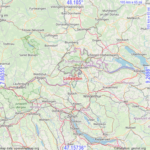
Lottstetten GPS coordinates[2]
47° 37' 59.988" North, 8° 34' 0.012" East
| Map corner | latitude | longitude |
|---|---|---|
| Upper-left | 48.105°, | 7.86355° |
| Center: | 47.63333°, | 8.56667° |
| Lower-right: | 47.15736°, | 9.2698° |
| Map W x H: | 105.4×105.4 km | = 65.5×65.5mi |
| max Lat: | 55.01917° ⇑99.4% North |
| Lottstetten: | 47.63333° |
| min Lat: | ⇓0.6% South 47.40724° |
| min Long | Lottstetten | max Long |
| 5.92978° | 8.56667° | 14.98853° |
| W 29.5%⇐ | ⇒70.5% E |
Elevation
Elevation of Lottstetten is 495 m = 1624 ft, and this is 245.9 m = 807 ft above average elevation for this country.
| Max E: |
1256 m = 4121 ft | 11.9% |
| Lottstetten | 495 m 1624 ft | |
| Avg. | 249.1 m = 817 ft | |
Min E: |
-5 m = -16 ft | 88.1% |
See also: Germany elevation on elevation.city.
Geographical zone
Lottstetten is located in North temperate zone (between Tropic of Cancer and the Arctic Circle). Distance of this North polar circle is 2104.8 km =1307.9 mi to North.| Distance of | km | miles | from Lottstetten |
|---|---|---|---|
| North Pole | 4710.7 | 2927.1 | to North |
| Arctic Circle | 2104.8 | 1307.9 | to North |
| Tropic Cancer | 2690.4 | 1671.7 | to South |
| Equator | 5296.3 | 3291 | to South |


Nearby cities:
15 places around Lottstetten: (largest is in red/bold)
• Blumberg
23.2 km =14.4 mi,  353°
353°
• Büsingen
11.5 km =7.1 mi,  52°
52°
• Dettighofen
6.2 km =3.9 mi,  259°
259°
• Eggingen
14.5 km =9 mi,  300°
300°
• Gailingen
15.8 km =9.8 mi,  63°
63°
• Gottmadingen
19.4 km =12.1 mi, 54°
• Hilzingen
22 km =13.7 mi, 47°
• Hohentengen
12.3 km =7.6 mi,  235°
235°
• Jestetten
1.9 km =1.2 mi,  0°
0°
• Lauchringen
18.9 km =11.7 mi,  267°
267°
• Rielasingen-Worblingen
23.4 km =14.5 mi, 61°
• Stühlingen
15.3 km =9.5 mi,  324°
324°
• Tengen
22.1 km =13.7 mi,  18°
18°
• Wutöschingen
15.2 km =9.4 mi,  281°
281°
• Ühlingen-Birkendorf
20.9 km =13 mi, 296°
Sources, notices
• [Note1] Compared only with cities in Germany existing in our database
• [Src1] Map data: © OpenStreetMap contributors (CC-BY-SA)
• [Src2] Other city data from geonames.org with taken over terms of usage.
• [Src3] Geographical zone / Annual Mean Temperature by Robert A. Rohde @ Wikipedia
