Lingen geodata
Lingen (Lower Saxony) is a populated place; located in Germany in Europe/Berlin (GMT+2) time zone. With population of 51,310 people, there are 216 cities with bigger population in this country. Compared to other cities in Germany, 77.7% of cities are located further ↓South; 89.6% of cities are located further →East and 88.6% of cities have higher elevation than Lingen. Note1


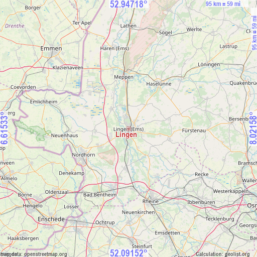
Lingen GPS coordinates[2]
52° 31' 17.148" North, 7° 19' 6.42" East
| Map corner | latitude | longitude |
|---|---|---|
| Upper-left | 52.94718°, | 6.61533° |
| Center: | 52.52143°, | 7.31845° |
| Lower-right: | 52.09152°, | 8.02158° |
| Map W x H: | 95.1×95.1 km | = 59.1×59.1mi |
| max Lat: | 55.01917° ⇑22.3% North |
| Lingen: | 52.52143° |
| min Lat: | ⇓77.7% South 47.40724° |
| min Long | Lingen | max Long |
| 5.92978° | 7.31845° | 14.98853° |
| W 10.4%⇐ | ⇒89.6% E |
Elevation
Elevation of Lingen is 25 m = 82 ft, and this is 224.1 m = 735 ft below average elevation for this country.
| Max E: |
1256 m = 4121 ft | 88.6% |
| Avg. | 249.1 m = 817 ft | |
| Lingen | 25 m = 82 ft | |
Min E: |
-5 m = -16 ft | 11.4% |
See also: Lingen elevation on elevation.city.
Geographical zone
Lingen is located in North temperate zone (between Tropic of Cancer and the Arctic Circle). Distance of this North polar circle is 1561.3 km =970.1 mi to North.| Distance of | km | miles | from Lingen |
|---|---|---|---|
| North Pole | 4167.2 | 2589.4 | to North |
| Arctic Circle | 1561.3 | 970.1 | to North |
| Tropic Cancer | 3233.9 | 2009.5 | to South |
| Equator | 5839.8 | 3628.7 | to South |


Nearby cities:
15 places around Lingen: (largest is in red/bold)
• Bawinkel
10.3 km =6.4 mi,  32°
32°
• Beesten
15.7 km =9.8 mi,  128°
128°
• Emsbüren
13.6 km =8.5 mi,  185°
185°
• Engden
16.3 km =10.1 mi,  214°
214°
• Freren
15.7 km =9.8 mi,  104°
104°
• Geeste
9.4 km =5.8 mi,  338°
338°
• Georgsdorf
16.7 km =10.4 mi,  287°
287°
• Gersten
15.1 km =9.4 mi,  62°
62°
• Langen
10.3 km =6.4 mi,  78°
78°
• Lengerich
14.9 km =9.3 mi, 75°
• Lohne
6.8 km =4.2 mi,  247°
247°
• Lünne
12.6 km =7.8 mi,  144°
144°
• Messingen
11.7 km =7.3 mi,  121°
121°
• Thuine
11.4 km =7.1 mi, 102°
• Wietmarschen
12.5 km =7.8 mi,  268°
268°
Sources, notices
• [Note1] Compared only with cities in Germany existing in our database
• [Src1] Map data: © OpenStreetMap contributors (CC-BY-SA)
• [Src2] Other city data from geonames.org with taken over terms of usage.
• [Src3] Geographical zone / Annual Mean Temperature by Robert A. Rohde @ Wikipedia
