Liepgarten geodata
Liepgarten (Mecklenburg-Vorpommern) is a populated place; located in Germany in Europe/Berlin (GMT+2) time zone. With population of 895 people, there are 7539 cities with bigger population in this country. Compared to other cities in Germany, 88.9% of cities are located further ↓South; 98.1% of cities are located further ←West and 98.1% of cities have higher elevation than Liepgarten. Note1
Administrative division(s):
- Level 1: Mecklenburg-Vorpommern
- Level 3: Vorpommern-Greifswald
- Level 4: Liepgarten


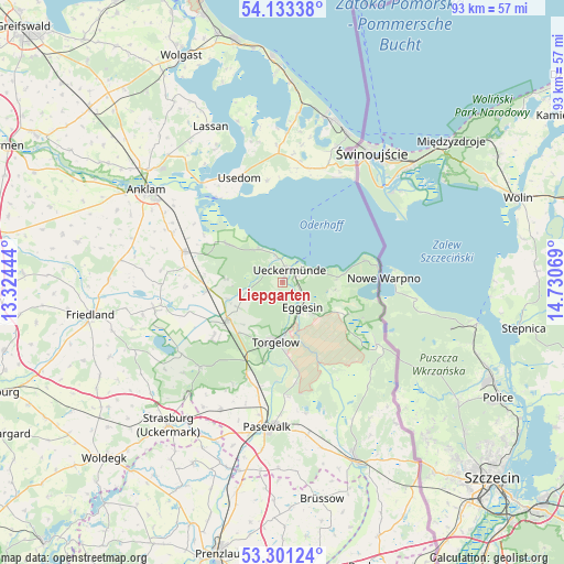
Liepgarten GPS coordinates[2]
53° 43' 9.732" North, 14° 1' 39.216" East
| Map corner | latitude | longitude |
|---|---|---|
| Upper-left | 54.13338°, | 13.32444° |
| Center: | 53.71937°, | 14.02756° |
| Lower-right: | 53.30124°, | 14.73069° |
| Map W x H: | 92.5×92.5 km | = 57.5×57.5mi |
| max Lat: | 55.01917° ⇑11.1% North |
| Liepgarten: | 53.71937° |
| min Lat: | ⇓88.9% South 47.40724° |
| min Long | Liepgarten | max Long |
| 5.92978° | 14.02756° | 14.98853° |
| W 98.1%⇐ | ⇒1.9% E |
Elevation
Elevation of Liepgarten is 2 m = 7 ft, and this is 247.1 m = 811 ft below average elevation for this country.
| Max E: |
1256 m = 4121 ft | 98.1% |
| Avg. | 249.1 m = 817 ft | |
| Liepgarten | 2 m = 7 ft | |
Min E: |
-5 m = -16 ft | 1.9% |
See also: Germany elevation on elevation.city.
Geographical zone
Liepgarten is located in North temperate zone (between Tropic of Cancer and the Arctic Circle). Distance of this North polar circle is 1428.1 km =887.4 mi to North.| Distance of | km | miles | from Liepgarten |
|---|---|---|---|
| North Pole | 4034 | 2506.6 | to North |
| Arctic Circle | 1428.1 | 887.4 | to North |
| Tropic Cancer | 3367.1 | 2092.2 | to South |
| Equator | 5973 | 3711.4 | to South |


Nearby cities:
15 places around Liepgarten: (largest is in red/bold)
• Ahlbeck
11.8 km =7.3 mi,  117°
117°
• Altwarp
15.8 km =9.8 mi,  81°
81°
• Dargen
18.8 km =11.7 mi,  7°
7°
• Ducherow
16.9 km =10.5 mi,  287°
287°
• Eggesin
5.6 km =3.5 mi,  141°
141°
• Ferdinandshof
11.3 km =7 mi,  235°
235°
• Hammer
13.5 km =8.4 mi,  193°
193°
• Jatznick
16.6 km =10.3 mi,  200°
200°
• Leopoldshagen
10.7 km =6.6 mi,  304°
304°
• Luckow
8.8 km =5.5 mi,  98°
98°
• Mönkebude
6.6 km =4.1 mi,  324°
324°
• Torgelow
9.5 km =5.9 mi, 185°
• Ueckermünde
2.4 km =1.5 mi,  28°
28°
• Usedom
18.6 km =11.6 mi,  338°
338°
• Wilhelmsburg
14.1 km =8.8 mi,  232°
232°
Sources, notices
• [Note1] Compared only with cities in Germany existing in our database
• [Src1] Map data: © OpenStreetMap contributors (CC-BY-SA)
• [Src2] Other city data from geonames.org with taken over terms of usage.
• [Src3] Geographical zone / Annual Mean Temperature by Robert A. Rohde @ Wikipedia
