Leitzkau geodata
Leitzkau (Saxony-Anhalt) is a populated place; located in Germany in Europe/Berlin (GMT+2) time zone. With population of 1,130 people, there are 6761 cities with bigger population in this country. Compared to other cities in Germany, 72.6% of cities are located further ↓South; 81.2% of cities are located further ←West and 67.1% of cities have higher elevation than Leitzkau. Note1


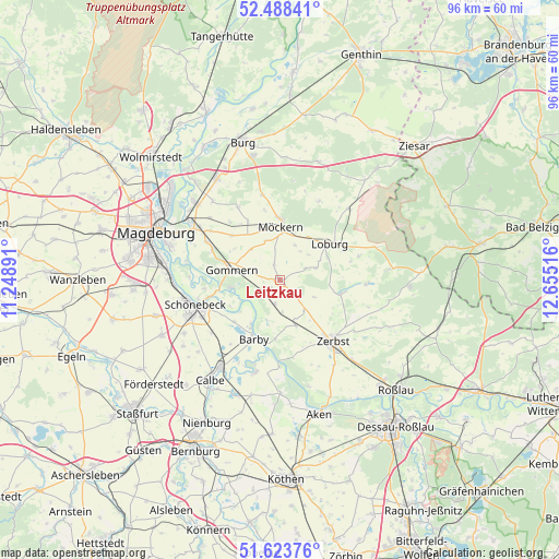
Leitzkau GPS coordinates[2]
52° 3' 29.448" North, 11° 57' 7.308" East
| Map corner | latitude | longitude |
|---|---|---|
| Upper-left | 52.48841°, | 11.24891° |
| Center: | 52.05818°, | 11.95203° |
| Lower-right: | 51.62376°, | 12.65516° |
| Map W x H: | 96.1×96.1 km | = 59.7×59.7mi |
| max Lat: | 55.01917° ⇑27.4% North |
| Leitzkau: | 52.05818° |
| min Lat: | ⇓72.6% South 47.40724° |
| min Long | Leitzkau | max Long |
| 5.92978° | 11.95203° | 14.98853° |
| W 81.2%⇐ | ⇒18.8% E |
Elevation
Elevation of Leitzkau is 107 m = 351 ft, and this is 142.1 m = 466 ft below average elevation for this country.
| Max E: |
1256 m = 4121 ft | 67.1% |
| Avg. | 249.1 m = 817 ft | |
| Leitzkau | 107 m = 351 ft | |
Min E: |
-5 m = -16 ft | 32.9% |
See also: Germany elevation on elevation.city.
Geographical zone
Leitzkau is located in North temperate zone (between Tropic of Cancer and the Arctic Circle). Distance of this North polar circle is 1612.8 km =1002.1 mi to North.| Distance of | km | miles | from Leitzkau |
|---|---|---|---|
| North Pole | 4218.7 | 2621.4 | to North |
| Arctic Circle | 1612.8 | 1002.1 | to North |
| Tropic Cancer | 3182.4 | 1977.5 | to South |
| Equator | 5788.3 | 3596.7 | to South |


Nearby cities:
15 places around Leitzkau: (largest is in red/bold)
• Barby
11.2 km =7 mi,  205°
205°
• Dannigkow
5.5 km =3.4 mi,  284°
284°
• Gommern
9 km =5.6 mi, 281°
• Güterglück
8.2 km =5.1 mi,  160°
160°
• Lindau
10.9 km =6.8 mi,  102°
102°
• Loburg
10.7 km =6.6 mi,  53°
53°
• Möckern
9.2 km =5.7 mi,  0°
0°
• Nedlitz
11.3 km =7 mi,  313°
313°
• Plötzky
10.3 km =6.4 mi,  266°
266°
• Pretzien
8.7 km =5.4 mi,  260°
260°
• Pömmelte
10.7 km =6.6 mi,  228°
228°
• Wahlitz
12.8 km =8 mi,  293°
293°
• Walternienburg
10.2 km =6.3 mi,  184°
184°
• Zeppernick
8.9 km =5.5 mi,  32°
32°
• Zerbst
13.7 km =8.5 mi,  138°
138°
Sources, notices
• [Note1] Compared only with cities in Germany existing in our database
• [Src1] Map data: © OpenStreetMap contributors (CC-BY-SA)
• [Src2] Other city data from geonames.org with taken over terms of usage.
• [Src3] Geographical zone / Annual Mean Temperature by Robert A. Rohde @ Wikipedia
