Barby geodata
Barby (Saxony-Anhalt) is a populated place; located in Germany in Europe/Berlin (GMT+2) time zone. With population of 4,646 people, there are 2966 cities with bigger population in this country. Compared to other cities in Germany, 71.8% of cities are located further ↓South; 80% of cities are located further ←West and 78.3% of cities have higher elevation than Barby. Note1


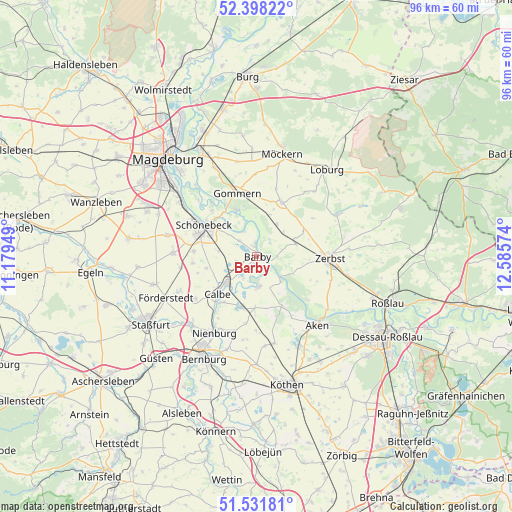
Barby GPS coordinates[2]
51° 58' 1.596" North, 11° 52' 57.396" East
| Map corner | latitude | longitude |
|---|---|---|
| Upper-left | 52.39822°, | 11.17949° |
| Center: | 51.96711°, | 11.88261° |
| Lower-right: | 51.53181°, | 12.58574° |
| Map W x H: | 96.3×96.3 km | = 59.8×59.8mi |
| max Lat: | 55.01917° ⇑28.2% North |
| Barby: | 51.96711° |
| min Lat: | ⇓71.8% South 47.40724° |
| min Long | Barby | max Long |
| 5.92978° | 11.88261° | 14.98853° |
| W 80%⇐ | ⇒20% E |
Elevation
Elevation of Barby is 52 m = 171 ft, and this is 197.1 m = 647 ft below average elevation for this country.
| Max E: |
1256 m = 4121 ft | 78.3% |
| Avg. | 249.1 m = 817 ft | |
| Barby | 52 m = 171 ft | |
Min E: |
-5 m = -16 ft | 21.7% |
See also: Germany elevation on elevation.city.
Geographical zone
Barby is located in North temperate zone (between Tropic of Cancer and the Arctic Circle). Distance of this North polar circle is 1623 km =1008.5 mi to North.| Distance of | km | miles | from Barby |
|---|---|---|---|
| North Pole | 4228.9 | 2627.7 | to North |
| Arctic Circle | 1623 | 1008.5 | to North |
| Tropic Cancer | 3172.3 | 1971.2 | to South |
| Equator | 5778.2 | 3590.4 | to South |


Nearby cities:
15 places around Barby: (largest is in red/bold)
• Breitenhagen
6.7 km =4.2 mi,  136°
136°
• Calbe
10 km =6.2 mi,  227°
227°
• Dannigkow
11.5 km =7.1 mi,  357°
357°
• Eggersdorf
11.9 km =7.4 mi,  274°
274°
• Gnadau
7.1 km =4.4 mi,  278°
278°
• Groß Rosenburg
5.6 km =3.5 mi,  173°
173°
• Güterglück
7.8 km =4.8 mi,  72°
72°
• Klein Mühlingen
9.7 km =6 mi,  256°
256°
• Leitzkau
11.2 km =7 mi,  25°
25°
• Plötzky
10.9 km =6.8 mi,  329°
329°
• Pretzien
9.5 km =5.9 mi,  336°
336°
• Pömmelte
4.4 km =2.7 mi,  313°
313°
• Schönebeck
11.8 km =7.3 mi,  297°
297°
• Tornitz
4.8 km =3 mi,  210°
210°
• Walternienburg
3.9 km =2.4 mi,  90°
90°
Sources, notices
• [Note1] Compared only with cities in Germany existing in our database
• [Src1] Map data: © OpenStreetMap contributors (CC-BY-SA)
• [Src2] Other city data from geonames.org with taken over terms of usage.
• [Src3] Geographical zone / Annual Mean Temperature by Robert A. Rohde @ Wikipedia
