Leibertingen geodata
Leibertingen (Baden-Württemberg) is a seat of a fourth-order administrative division; located in Germany in Europe/Berlin (GMT+2) time zone. With population of 2,307 people, there are 4659 cities with bigger population in this country. Compared to other cities in Germany, 95% of cities are located further ↑North; 65.2% of cities are located further →East and 99.1% of cities have lower elevation than Leibertingen. Note1
Administrative division(s):
- Level 1: Baden-Württemberg
- Level 2: Tübingen Region
- Level 3: Landkreis Sigmaringen
- Level 4: Leibertingen


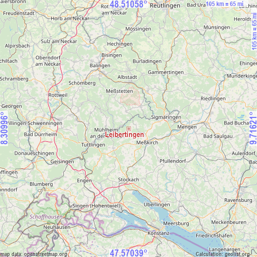
Leibertingen GPS coordinates[2]
48° 2' 33.468" North, 9° 0' 47.088" East
| Map corner | latitude | longitude |
|---|---|---|
| Upper-left | 48.51058°, | 8.30996° |
| Center: | 48.04263°, | 9.01308° |
| Lower-right: | 47.57039°, | 9.71621° |
| Map W x H: | 104.5×104.5 km | = 64.9×64.9mi |
| max Lat: | 55.01917° ⇑95% North |
| Leibertingen: | 48.04263° |
| min Lat: | ⇓5% South 47.40724° |
| min Long | Leibertingen | max Long |
| 5.92978° | 9.01308° | 14.98853° |
| W 34.8%⇐ | ⇒65.2% E |
Elevation
Elevation of Leibertingen is 797 m = 2615 ft, and this is 547.9 m = 1798 ft above average elevation for this country.
| Max E: |
1256 m = 4121 ft | 0.90000000000001% |
| Leibertingen | 797 m 2615 ft | |
| Avg. | 249.1 m = 817 ft | |
Min E: |
-5 m = -16 ft | 99.1% |
See also: Germany elevation on elevation.city.
Geographical zone
Leibertingen is located in North temperate zone (between Tropic of Cancer and the Arctic Circle). Distance of this North polar circle is 2059.3 km =1279.6 mi to North.| Distance of | km | miles | from Leibertingen |
|---|---|---|---|
| North Pole | 4665.2 | 2898.8 | to North |
| Arctic Circle | 2059.3 | 1279.6 | to North |
| Tropic Cancer | 2735.9 | 1700 | to South |
| Equator | 5341.8 | 3319.2 | to South |


Nearby cities:
15 places around Leibertingen: (largest is in red/bold)
• Beuron
3.5 km =2.2 mi,  283°
283°
• Buchheim
4.1 km =2.5 mi,  209°
209°
• Bärenthal
6.5 km =4 mi,  294°
294°
• Fridingen an der Donau
7.2 km =4.5 mi,  248°
248°
• Inzigkofen
12.8 km =8 mi,  76°
76°
• Irndorf
4.4 km =2.7 mi,  307°
307°
• Kolbingen
9.2 km =5.7 mi, 276°
• Königsheim
12.6 km =7.8 mi,  300°
300°
• Meßkirch
9.3 km =5.8 mi,  125°
125°
• Neuhausen ob Eck
10.1 km =6.3 mi,  219°
219°
• Nusplingen
13.5 km =8.4 mi,  317°
317°
• Renquishausen
9.5 km =5.9 mi, 298°
• Sauldorf
13.1 km =8.1 mi,  147°
147°
• Schwenningen
6.5 km =4 mi,  351°
351°
• Stetten am Kalten Markt
10.3 km =6.4 mi,  27°
27°
Sources, notices
• [Note1] Compared only with cities in Germany existing in our database
• [Src1] Map data: © OpenStreetMap contributors (CC-BY-SA)
• [Src2] Other city data from geonames.org with taken over terms of usage.
• [Src3] Geographical zone / Annual Mean Temperature by Robert A. Rohde @ Wikipedia
