Sauldorf geodata
Sauldorf (Baden-Württemberg) is a seat of a fourth-order administrative division; located in Germany in Europe/Berlin (GMT+2) time zone. With population of 2,501 people, there are 4441 cities with bigger population in this country. Compared to other cities in Germany, 96.1% of cities are located further ↑North; 63.9% of cities are located further →East and 95.8% of cities have lower elevation than Sauldorf. Note1
Administrative division(s):
- Level 1: Baden-Württemberg
- Level 2: Tübingen Region
- Level 3: Landkreis Sigmaringen
- Level 4: Sauldorf


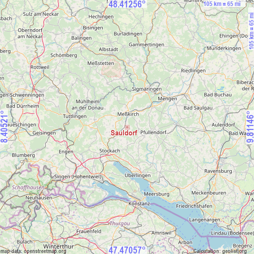
Sauldorf GPS coordinates[2]
47° 56' 37.356" North, 9° 6' 29.988" East
| Map corner | latitude | longitude |
|---|---|---|
| Upper-left | 48.41256°, | 8.40521° |
| Center: | 47.94371°, | 9.10833° |
| Lower-right: | 47.47057°, | 9.81146° |
| Map W x H: | 104.7×104.7 km | = 65.1×65.1mi |
| max Lat: | 55.01917° ⇑96.1% North |
| Sauldorf: | 47.94371° |
| min Lat: | ⇓3.9% South 47.40724° |
| min Long | Sauldorf | max Long |
| 5.92978° | 9.10833° | 14.98853° |
| W 36.1%⇐ | ⇒63.9% E |
Elevation
Elevation of Sauldorf is 621 m = 2037 ft, and this is 371.9 m = 1220 ft above average elevation for this country.
| Max E: |
1256 m = 4121 ft | 4.2% |
| Sauldorf | 621 m 2037 ft | |
| Avg. | 249.1 m = 817 ft | |
Min E: |
-5 m = -16 ft | 95.8% |
See also: Germany elevation on elevation.city.
Geographical zone
Sauldorf is located in North temperate zone (between Tropic of Cancer and the Arctic Circle). Distance of this North polar circle is 2070.3 km =1286.4 mi to North.| Distance of | km | miles | from Sauldorf |
|---|---|---|---|
| North Pole | 4676.2 | 2905.7 | to North |
| Arctic Circle | 2070.3 | 1286.4 | to North |
| Tropic Cancer | 2724.9 | 1693.2 | to South |
| Equator | 5330.8 | 3312.4 | to South |


Nearby cities:
15 places around Sauldorf: (largest is in red/bold)
• Bodman-Ludwigshafen
14.5 km =9 mi,  195°
195°
• Buchheim
11.7 km =7.3 mi,  309°
309°
• Herdwangen-Schönach
12.5 km =7.8 mi,  146°
146°
• Inzigkofen
15.1 km =9.4 mi,  20°
20°
• Krauchenwies
13.2 km =8.2 mi,  52°
52°
• Leibertingen
13.1 km =8.1 mi,  327°
327°
• Meßkirch
5.7 km =3.5 mi,  4°
4°
• Mühlingen
7.5 km =4.7 mi,  246°
246°
• Neuhausen ob Eck
13.8 km =8.6 mi,  283°
283°
• Orsingen-Nenzingen
15.8 km =9.8 mi,  224°
224°
• Owingen
15.6 km =9.7 mi,  162°
162°
• Pfullendorf
11.3 km =7 mi,  99°
99°
• Rot
2.3 km =1.4 mi,  186°
186°
• Stockach
12.7 km =7.9 mi, 215°
• Wald
4.5 km =2.8 mi, 104°
Sources, notices
• [Note1] Compared only with cities in Germany existing in our database
• [Src1] Map data: © OpenStreetMap contributors (CC-BY-SA)
• [Src2] Other city data from geonames.org with taken over terms of usage.
• [Src3] Geographical zone / Annual Mean Temperature by Robert A. Rohde @ Wikipedia
