Buchheim geodata
Buchheim (Baden-Württemberg) is a seat of a fourth-order administrative division; located in Germany in Europe/Berlin (GMT+2) time zone. In our database, there are 11009 cities with bigger population. Compared to other cities in Germany, 95.4% of cities are located further ↑North; 65.6% of cities are located further →East and 99.1% of cities have lower elevation than Buchheim. Note1
Administrative division(s):
- Level 1: Baden-Württemberg
- Level 2: Freiburg Region
- Level 3: Landkreis Tuttlingen
- Level 4: Buchheim


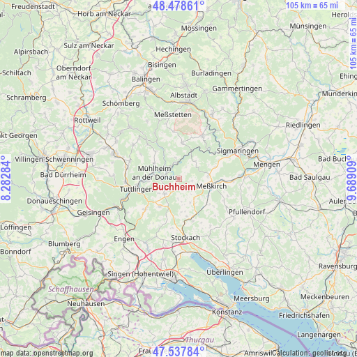
Buchheim GPS coordinates[2]
48° 0' 37.332" North, 8° 59' 9.456" East
| Map corner | latitude | longitude |
|---|---|---|
| Upper-left | 48.47861°, | 8.28284° |
| Center: | 48.01037°, | 8.98596° |
| Lower-right: | 47.53784°, | 9.68909° |
| Map W x H: | 104.6×104.6 km | = 65×65mi |
| max Lat: | 55.01917° ⇑95.4% North |
| Buchheim: | 48.01037° |
| min Lat: | ⇓4.6% South 47.40724° |
| min Long | Buchheim | max Long |
| 5.92978° | 8.98596° | 14.98853° |
| W 34.4%⇐ | ⇒65.6% E |
Elevation
Elevation of Buchheim is 791 m = 2595 ft, and this is 541.9 m = 1778 ft above average elevation for this country.
| Max E: |
1256 m = 4121 ft | 0.90000000000001% |
| Buchheim | 791 m 2595 ft | |
| Avg. | 249.1 m = 817 ft | |
Min E: |
-5 m = -16 ft | 99.1% |
See also: Germany elevation on elevation.city.
Geographical zone
Buchheim is located in North temperate zone (between Tropic of Cancer and the Arctic Circle). Distance of this North polar circle is 2062.9 km =1281.8 mi to North.| Distance of | km | miles | from Buchheim |
|---|---|---|---|
| North Pole | 4668.8 | 2901.1 | to North |
| Arctic Circle | 2062.9 | 1281.8 | to North |
| Tropic Cancer | 2732.3 | 1697.8 | to South |
| Equator | 5338.3 | 3317.1 | to South |


Nearby cities:
15 places around Buchheim: (largest is in red/bold)
• Beuron
4.6 km =2.9 mi,  341°
341°
• Bärenthal
7.4 km =4.6 mi,  327°
327°
• Emmingen-Liptingen
11.5 km =7.1 mi,  221°
221°
• Fridingen an der Donau
4.8 km =3 mi,  282°
282°
• Irndorf
6.4 km =4 mi,  347°
347°
• Kolbingen
8.5 km =5.3 mi,  303°
303°
• Leibertingen
4.1 km =2.5 mi,  29°
29°
• Meßkirch
9.7 km =6 mi,  100°
100°
• Mühlingen
10.7 km =6.6 mi,  167°
167°
• Neuhausen ob Eck
6 km =3.7 mi,  225°
225°
• Renquishausen
10.3 km =6.4 mi,  321°
321°
• Rot
13.2 km =8.2 mi,  137°
137°
• Sauldorf
11.7 km =7.3 mi,  129°
129°
• Schwenningen
10 km =6.2 mi,  5°
5°
• Tuttlingen
12.8 km =8 mi,  257°
257°
Sources, notices
• [Note1] Compared only with cities in Germany existing in our database
• [Src1] Map data: © OpenStreetMap contributors (CC-BY-SA)
• [Src2] Other city data from geonames.org with taken over terms of usage.
• [Src3] Geographical zone / Annual Mean Temperature by Robert A. Rohde @ Wikipedia
