Meßkirch geodata
Meßkirch (Baden-Württemberg) is a populated place; located in Germany in Europe/Berlin (GMT+2) time zone. With population of 8,736 people, there are 1836 cities with bigger population in this country. Compared to other cities in Germany, 95.6% of cities are located further ↑North; 63.8% of cities are located further →East and 95.2% of cities have lower elevation than Meßkirch. Note1
Administrative division(s):
- Level 1: Baden-Württemberg
- Level 2: Tübingen Region
- Level 3: Landkreis Sigmaringen
- Level 4: Meßkirch


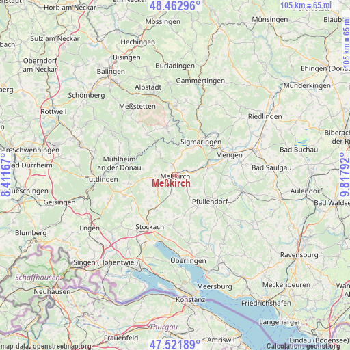
Meßkirch GPS coordinates[2]
47° 59' 40.452" North, 9° 6' 53.244" East
| Map corner | latitude | longitude |
|---|---|---|
| Upper-left | 48.46296°, | 8.41167° |
| Center: | 47.99457°, | 9.11479° |
| Lower-right: | 47.52189°, | 9.81792° |
| Map W x H: | 104.6×104.6 km | = 65×65mi |
| max Lat: | 55.01917° ⇑95.6% North |
| Meßkirch: | 47.99457° |
| min Lat: | ⇓4.4% South 47.40724° |
| min Long | Meßkirch | max Long |
| 5.92978° | 9.11479° | 14.98853° |
| W 36.2%⇐ | ⇒63.8% E |
Elevation
Elevation of Meßkirch is 603 m = 1978 ft, and this is 353.9 m = 1161 ft above average elevation for this country.
| Max E: |
1256 m = 4121 ft | 4.8% |
| Meßkirch | 603 m 1978 ft | |
| Avg. | 249.1 m = 817 ft | |
Min E: |
-5 m = -16 ft | 95.2% |
See also: Germany elevation on elevation.city.
Geographical zone
Meßkirch is located in North temperate zone (between Tropic of Cancer and the Arctic Circle). Distance of this North polar circle is 2064.7 km =1282.9 mi to North.| Distance of | km | miles | from Meßkirch |
|---|---|---|---|
| North Pole | 4670.6 | 2902.2 | to North |
| Arctic Circle | 2064.7 | 1282.9 | to North |
| Tropic Cancer | 2730.6 | 1696.7 | to South |
| Equator | 5336.5 | 3315.9 | to South |


Nearby cities:
15 places around Meßkirch: (largest is in red/bold)
• Beuron
12.6 km =7.8 mi,  299°
299°
• Buchheim
9.7 km =6 mi,  280°
280°
• Fridingen an der Donau
14.5 km =9 mi, 281°
• Inzigkofen
9.7 km =6 mi,  29°
29°
• Irndorf
13.6 km =8.5 mi,  306°
306°
• Krauchenwies
10.2 km =6.3 mi,  76°
76°
• Leibertingen
9.3 km =5.8 mi, 305°
• Mühlingen
11.3 km =7 mi,  220°
220°
• Neuhausen ob Eck
14.1 km =8.8 mi,  260°
260°
• Pfullendorf
13.1 km =8.1 mi,  125°
125°
• Rot
8 km =5 mi,  185°
185°
• Sauldorf
5.7 km =3.5 mi,  184°
184°
• Sigmaringen
13.5 km =8.4 mi,  39°
39°
• Sigmaringendorf
13.5 km =8.4 mi,  54°
54°
• Wald
7.8 km =4.8 mi,  150°
150°
Sources, notices
• [Note1] Compared only with cities in Germany existing in our database
• [Src1] Map data: © OpenStreetMap contributors (CC-BY-SA)
• [Src2] Other city data from geonames.org with taken over terms of usage.
• [Src3] Geographical zone / Annual Mean Temperature by Robert A. Rohde @ Wikipedia
