Kreut geodata
Kreut (Bavaria) is a populated place; located in Germany in Europe/Berlin (GMT+2) time zone. With population of 3,889 people, there are 3357 cities with bigger population in this country. Compared to other cities in Germany, 97.8% of cities are located further ↑North; 74% of cities are located further ←West and 97.3% of cities have lower elevation than Kreut. Note1
Administrative division(s):
- Level 1: Bavaria
- Level 2: Upper Bavaria
- Level 3: Landkreis Bad Tölz-Wolfratshausen
- Level 4: Königsdorf


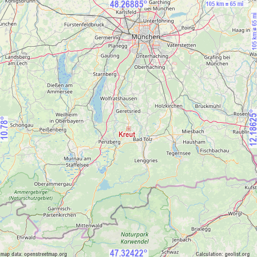
Kreut GPS coordinates[2]
47° 47' 55.248" North, 11° 28' 59.232" East
| Map corner | latitude | longitude |
|---|---|---|
| Upper-left | 48.26885°, | 10.78° |
| Center: | 47.79868°, | 11.48312° |
| Lower-right: | 47.32422°, | 12.18625° |
| Map W x H: | 105×105 km | = 65.2×65.2mi |
| max Lat: | 55.01917° ⇑97.8% North |
| Kreut: | 47.79868° |
| min Lat: | ⇓2.2% South 47.40724° |
| min Long | Kreut | max Long |
| 5.92978° | 11.48312° | 14.98853° |
| W 74%⇐ | ⇒26% E |
Elevation
Elevation of Kreut is 676 m = 2218 ft, and this is 426.9 m = 1401 ft above average elevation for this country.
| Max E: |
1256 m = 4121 ft | 2.7% |
| Kreut | 676 m 2218 ft | |
| Avg. | 249.1 m = 817 ft | |
Min E: |
-5 m = -16 ft | 97.3% |
See also: Germany elevation on elevation.city.
Geographical zone
Kreut is located in North temperate zone (between Tropic of Cancer and the Arctic Circle). Distance of this North polar circle is 2086.5 km =1296.5 mi to North.| Distance of | km | miles | from Kreut |
|---|---|---|---|
| North Pole | 4692.3 | 2915.7 | to North |
| Arctic Circle | 2086.5 | 1296.5 | to North |
| Tropic Cancer | 2708.8 | 1683.2 | to South |
| Equator | 5314.7 | 3302.4 | to South |


Nearby cities:
15 places around Kreut: (largest is in red/bold)
• Bad Heilbrunn
6 km =3.7 mi,  197°
197°
• Bad Tölz
7 km =4.3 mi,  126°
126°
• Benediktbeuern
11.5 km =7.1 mi,  206°
206°
• Bichl
10.2 km =6.3 mi, 211°
• Dietramszell
10.1 km =6.3 mi,  56°
56°
• Eurasburg
8.4 km =5.2 mi,  316°
316°
• Gaißach
9.2 km =5.7 mi, 125°
• Geretsried
6.6 km =4.1 mi,  358°
358°
• Greiling
10.6 km =6.6 mi,  109°
109°
• Königsdorf
1.9 km =1.2 mi,  354°
354°
• Penzberg
9.4 km =5.8 mi,  237°
237°
• Reichersbeuern
11.8 km =7.3 mi, 107°
• Reichertshausen
12.5 km =7.8 mi,  26°
26°
• Sachsenkam
12 km =7.5 mi,  86°
86°
• Wackersberg
8.8 km =5.5 mi,  145°
145°
Sources, notices
• [Note1] Compared only with cities in Germany existing in our database
• [Src1] Map data: © OpenStreetMap contributors (CC-BY-SA)
• [Src2] Other city data from geonames.org with taken over terms of usage.
• [Src3] Geographical zone / Annual Mean Temperature by Robert A. Rohde @ Wikipedia
