Köpenick geodata
Köpenick (Berlin) is a section of populated place; located in Germany in Europe/Berlin (GMT+2) time zone. With population of 60,128 people, there are 173 cities with bigger population in this country. Compared to other cities in Germany, 76.8% of cities are located further ↓South; 96.2% of cities are located further ←West and 86.3% of cities have higher elevation than Köpenick. Note1


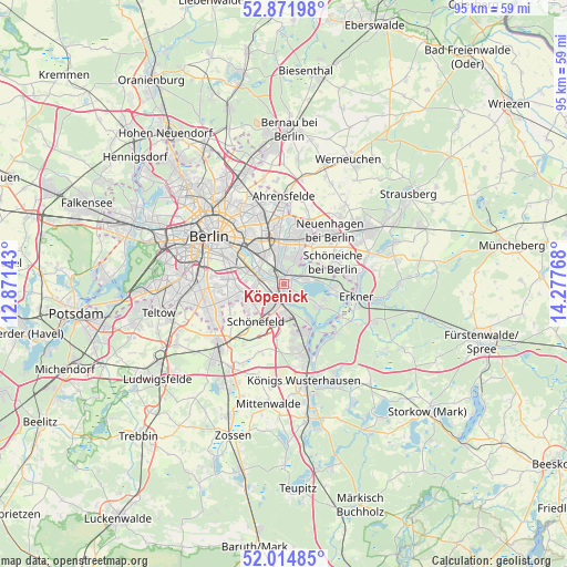
Köpenick GPS coordinates[2]
52° 26' 43.8" North, 13° 34' 28.38" East
| Map corner | latitude | longitude |
|---|---|---|
| Upper-left | 52.87198°, | 12.87143° |
| Center: | 52.4455°, | 13.57455° |
| Lower-right: | 52.01485°, | 14.27768° |
| Map W x H: | 95.3×95.3 km | = 59.2×59.2mi |
| max Lat: | 55.01917° ⇑23.2% North |
| Köpenick: | 52.4455° |
| min Lat: | ⇓76.8% South 47.40724° |
| min Long | Köpenick | max Long |
| 5.92978° | 13.57455° | 14.98853° |
| W 96.2%⇐ | ⇒3.8% E |
Elevation
Elevation of Köpenick is 32 m = 105 ft, and this is 217.1 m = 712 ft below average elevation for this country.
| Max E: |
1256 m = 4121 ft | 86.3% |
| Avg. | 249.1 m = 817 ft | |
| Köpenick | 32 m = 105 ft | |
Min E: |
-5 m = -16 ft | 13.7% |
See also: Köpenick elevation on elevation.city.
Geographical zone
Köpenick is located in North temperate zone (between Tropic of Cancer and the Arctic Circle). Distance of this North polar circle is 1569.8 km =975.4 mi to North.| Distance of | km | miles | from Köpenick |
|---|---|---|---|
| North Pole | 4175.7 | 2594.7 | to North |
| Arctic Circle | 1569.8 | 975.4 | to North |
| Tropic Cancer | 3225.5 | 2004.2 | to South |
| Equator | 5831.4 | 3623.5 | to South |


Nearby cities:
15 places around Köpenick: (largest is in red/bold)
• Adlershof
2.1 km =1.3 mi,  237°
237°
• Altglienicke
4.6 km =2.9 mi,  214°
214°
• Baumschulenweg
6.5 km =4 mi,  290°
290°
• Berlin Köpenick
0.6 km =0.4 mi,  122°
122°
• Biesdorf
7.2 km =4.5 mi,  348°
348°
• Bohnsdorf
5.7 km =3.5 mi,  180°
180°
• Friedrichshagen
3.4 km =2.1 mi,  80°
80°
• Grünau
3.3 km =2.1 mi,  173°
173°
• Johannisthal
4.6 km =2.9 mi,  271°
271°
• Karlshorst
5.2 km =3.2 mi,  326°
326°
• Mahlsdorf
7.6 km =4.7 mi,  20°
20°
• Müggelheim
7.2 km =4.5 mi, 122°
• Niederschöneweide
4.2 km =2.6 mi, 285°
• Oberschöneweide
4 km =2.5 mi,  295°
295°
• Rudow
6.5 km =4 mi,  248°
248°
Sources, notices
• [Note1] Compared only with cities in Germany existing in our database
• [Src1] Map data: © OpenStreetMap contributors (CC-BY-SA)
• [Src2] Other city data from geonames.org with taken over terms of usage.
• [Src3] Geographical zone / Annual Mean Temperature by Robert A. Rohde @ Wikipedia
