Heinersbrück geodata
Heinersbrück (Brandenburg) is a seat of a fourth-order administrative division; located in Germany in Europe/Berlin (GMT+2) time zone. With population of 692 people, there are 8351 cities with bigger population in this country. Compared to other cities in Germany, 70.2% of cities are located further ↓South; 99.3% of cities are located further ←West and 75% of cities have higher elevation than Heinersbrück. Note1
Administrative division(s):
- Level 1: Brandenburg
- Level 3: Landkreis Spree-Neiße
- Level 4: Heinersbrück


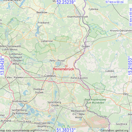
Heinersbrück GPS coordinates[2]
51° 49' 11.496" North, 14° 30' 26.64" East
| Map corner | latitude | longitude |
|---|---|---|
| Upper-left | 52.25239°, | 13.80428° |
| Center: | 51.81986°, | 14.5074° |
| Lower-right: | 51.38313°, | 15.21053° |
| Map W x H: | 96.7×96.7 km | = 60.1×60.1mi |
| max Lat: | 55.01917° ⇑29.8% North |
| Heinersbrück: | 51.81986° |
| min Lat: | ⇓70.2% South 47.40724° |
| min Long | Heinersbrück | max Long |
| 5.92978° | 14.5074° | 14.98853° |
| W 99.3%⇐ | ⇒0.7% E |
Elevation
Elevation of Heinersbrück is 63 m = 207 ft, and this is 186.1 m = 611 ft below average elevation for this country.
| Max E: |
1256 m = 4121 ft | 75% |
| Avg. | 249.1 m = 817 ft | |
| Heinersbrück | 63 m = 207 ft | |
Min E: |
-5 m = -16 ft | 25% |
See also: Germany elevation on elevation.city.
Geographical zone
Heinersbrück is located in North temperate zone (between Tropic of Cancer and the Arctic Circle). Distance of this North polar circle is 1639.3 km =1018.6 mi to North.| Distance of | km | miles | from Heinersbrück |
|---|---|---|---|
| North Pole | 4245.2 | 2637.8 | to North |
| Arctic Circle | 1639.3 | 1018.6 | to North |
| Tropic Cancer | 3155.9 | 1961 | to South |
| Equator | 5761.8 | 3580.2 | to South |


Nearby cities:
15 places around Heinersbrück: (largest is in red/bold)
• Briesen
18.1 km =11.2 mi,  268°
268°
• Cottbus
14.1 km =8.8 mi,  240°
240°
• Drachhausen
15.3 km =9.5 mi,  300°
300°
• Drehnow
11 km =6.8 mi, 298°
• Forst
13.1 km =8.1 mi,  135°
135°
• Groß Oßnig
18.8 km =11.7 mi,  212°
212°
• Guben
20.3 km =12.6 mi,  44°
44°
• Guhrow
19.1 km =11.9 mi, 267°
• Jänschwalde
4.6 km =2.9 mi,  352°
352°
• Kolkwitz
19.3 km =12 mi,  246°
246°
• Komptendorf
15.2 km =9.4 mi,  189°
189°
• Laubsdorf
16.8 km =10.4 mi,  195°
195°
• Peitz
7.9 km =4.9 mi, 303°
• Schenkendöbern
17.6 km =10.9 mi,  29°
29°
• Tauer
9.7 km =6 mi,  336°
336°
Sources, notices
• [Note1] Compared only with cities in Germany existing in our database
• [Src1] Map data: © OpenStreetMap contributors (CC-BY-SA)
• [Src2] Other city data from geonames.org with taken over terms of usage.
• [Src3] Geographical zone / Annual Mean Temperature by Robert A. Rohde @ Wikipedia
