Klingenstein geodata
Klingenstein (Baden-Württemberg) is a populated place; located in Germany in Europe/Berlin (GMT+2) time zone. With population of 15,643 people, there are 1026 cities with bigger population in this country. Compared to other cities in Germany, 90% of cities are located further ↑North; 51.4% of cities are located further →East and 88.4% of cities have lower elevation than Klingenstein. Note1
Administrative division(s):
- Level 1: Baden-Württemberg
- Level 2: Tübingen Region
- Level 3: Alb-Donau-Kreis
- Level 4: Blaustein


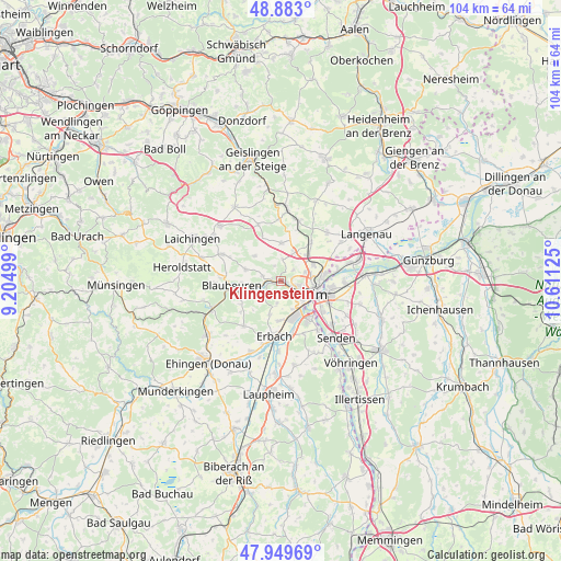
Klingenstein GPS coordinates[2]
48° 25' 6.564" North, 9° 54' 29.232" East
| Map corner | latitude | longitude |
|---|---|---|
| Upper-left | 48.883°, | 9.20499° |
| Center: | 48.41849°, | 9.90812° |
| Lower-right: | 47.94969°, | 10.61125° |
| Map W x H: | 103.8×103.8 km | = 64.5×64.5mi |
| max Lat: | 55.01917° ⇑90% North |
| Klingenstein: | 48.41849° |
| min Lat: | ⇓10% South 47.40724° |
| min Long | Klingenstein | max Long |
| 5.92978° | 9.90812° | 14.98853° |
| W 48.6%⇐ | ⇒51.4% E |
Elevation
Elevation of Klingenstein is 498 m = 1634 ft, and this is 248.9 m = 817 ft above average elevation for this country.
| Max E: |
1256 m = 4121 ft | 11.6% |
| Klingenstein | 498 m 1634 ft | |
| Avg. | 249.1 m = 817 ft | |
Min E: |
-5 m = -16 ft | 88.4% |
See also: Germany elevation on elevation.city.
Geographical zone
Klingenstein is located in North temperate zone (between Tropic of Cancer and the Arctic Circle). Distance of this North polar circle is 2017.5 km =1253.6 mi to North.| Distance of | km | miles | from Klingenstein |
|---|---|---|---|
| North Pole | 4623.4 | 2872.8 | to North |
| Arctic Circle | 2017.5 | 1253.6 | to North |
| Tropic Cancer | 2777.7 | 1726 | to South |
| Equator | 5383.6 | 3345.2 | to South |


Nearby cities:
15 places around Klingenstein: (largest is in red/bold)
• Beimerstetten
9.1 km =5.7 mi,  37°
37°
• Berghülen
12 km =7.5 mi,  295°
295°
• Bernstadt
12.5 km =7.8 mi, 43°
• Blaubeuren
9.2 km =5.7 mi,  265°
265°
• Blaustein
0.7 km =0.4 mi,  107°
107°
• Breitingen
12.6 km =7.8 mi,  29°
29°
• Dornstadt
6 km =3.7 mi, 26°
• Erbach
10.1 km =6.3 mi,  188°
188°
• Holzkirch
14.1 km =8.8 mi, 27°
• Lonsee
13.9 km =8.6 mi,  3°
3°
• Neu-Ulm
8.1 km =5 mi, 110°
• Oberdischingen
14.3 km =8.9 mi,  202°
202°
• Schelklingen
13.8 km =8.6 mi,  249°
249°
• Ulm
6.6 km =4.1 mi, 109°
• Westerstetten
11.7 km =7.3 mi,  17°
17°
Sources, notices
• [Note1] Compared only with cities in Germany existing in our database
• [Src1] Map data: © OpenStreetMap contributors (CC-BY-SA)
• [Src2] Other city data from geonames.org with taken over terms of usage.
• [Src3] Geographical zone / Annual Mean Temperature by Robert A. Rohde @ Wikipedia
