Schelklingen geodata
Schelklingen (Baden-Württemberg) is a populated place; located in Germany in Europe/Berlin (GMT+2) time zone. With population of 7,130 people, there are 2154 cities with bigger population in this country. Compared to other cities in Germany, 90.5% of cities are located further ↑North; 53.9% of cities are located further →East and 91.7% of cities have lower elevation than Schelklingen. Note1
Administrative division(s):
- Level 1: Baden-Württemberg
- Level 2: Tübingen Region
- Level 3: Alb-Donau-Kreis
- Level 4: Schelklingen


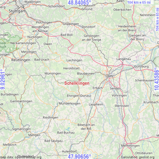
Schelklingen GPS coordinates[2]
48° 22' 32.7" North, 9° 43' 57.828" East
| Map corner | latitude | longitude |
|---|---|---|
| Upper-left | 48.84065°, | 9.02961° |
| Center: | 48.37575°, | 9.73273° |
| Lower-right: | 47.90656°, | 10.43586° |
| Map W x H: | 103.9×103.9 km | = 64.6×64.6mi |
| max Lat: | 55.01917° ⇑90.5% North |
| Schelklingen: | 48.37575° |
| min Lat: | ⇓9.5% South 47.40724° |
| min Long | Schelklingen | max Long |
| 5.92978° | 9.73273° | 14.98853° |
| W 46.1%⇐ | ⇒53.9% E |
Elevation
Elevation of Schelklingen is 538 m = 1765 ft, and this is 288.9 m = 948 ft above average elevation for this country.
| Max E: |
1256 m = 4121 ft | 8.3% |
| Schelklingen | 538 m 1765 ft | |
| Avg. | 249.1 m = 817 ft | |
Min E: |
-5 m = -16 ft | 91.7% |
See also: Germany elevation on elevation.city.
Geographical zone
Schelklingen is located in North temperate zone (between Tropic of Cancer and the Arctic Circle). Distance of this North polar circle is 2022.3 km =1256.6 mi to North.| Distance of | km | miles | from Schelklingen |
|---|---|---|---|
| North Pole | 4628.2 | 2875.8 | to North |
| Arctic Circle | 2022.3 | 1256.6 | to North |
| Tropic Cancer | 2773 | 1723.1 | to South |
| Equator | 5378.9 | 3342.3 | to South |


Nearby cities:
15 places around Schelklingen: (largest is in red/bold)
• Allmendingen
5.1 km =3.2 mi,  187°
187°
• Altheim
6 km =3.7 mi,  152°
152°
• Berghülen
10 km =6.2 mi,  12°
12°
• Blaubeuren
5.6 km =3.5 mi,  43°
43°
• Blaustein
14.4 km =8.9 mi,  71°
71°
• Dettingen
12.6 km =7.8 mi,  183°
183°
• Ehingen
10.4 km =6.5 mi, 182°
• Erbach
12.6 km =7.8 mi,  114°
114°
• Ersingen
12.9 km =8 mi,  135°
135°
• Griesingen
12.7 km =7.9 mi,  162°
162°
• Klingenstein
13.8 km =8.6 mi, 69°
• Laichingen
13.1 km =8.1 mi,  344°
344°
• Mehrstetten
12.3 km =7.6 mi,  270°
270°
• Oberdischingen
11.2 km =7 mi, 138°
• Öpfingen
11.2 km =7 mi, 152°
Sources, notices
• [Note1] Compared only with cities in Germany existing in our database
• [Src1] Map data: © OpenStreetMap contributors (CC-BY-SA)
• [Src2] Other city data from geonames.org with taken over terms of usage.
• [Src3] Geographical zone / Annual Mean Temperature by Robert A. Rohde @ Wikipedia
