Ulm geodata
Ulm (Baden-Württemberg) is a seat of a third-order administrative division; located in Germany in Europe/Berlin (GMT+2) time zone. With population of 120,451 people, there are 74 cities with bigger population in this country. Compared to other cities in Germany, 90.3% of cities are located further ↑North; 50.1% of cities are located further →East and 86.3% of cities have lower elevation than Ulm. Note1
Administrative division(s):
- Level 1: Baden-Württemberg
- Level 2: Tübingen Region
- Level 3: Stadtkreis Ulm
- Level 4: Ulm, Universitätsstadt


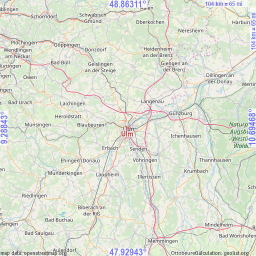
Ulm GPS coordinates[2]
48° 23' 54.276" North, 9° 59' 29.58" East
| Map corner | latitude | longitude |
|---|---|---|
| Upper-left | 48.86311°, | 9.28843° |
| Center: | 48.39841°, | 9.99155° |
| Lower-right: | 47.92943°, | 10.69468° |
| Map W x H: | 103.8×103.8 km | = 64.5×64.5mi |
| max Lat: | 55.01917° ⇑90.3% North |
| Ulm: | 48.39841° |
| min Lat: | ⇓9.7% South 47.40724° |
| min Long | Ulm | max Long |
| 5.92978° | 9.99155° | 14.98853° |
| W 49.9%⇐ | ⇒50.1% E |
Elevation
Elevation of Ulm is 480 m = 1575 ft, and this is 230.9 m = 758 ft above average elevation for this country.
| Max E: |
1256 m = 4121 ft | 13.7% |
| Ulm | 480 m 1575 ft | |
| Avg. | 249.1 m = 817 ft | |
Min E: |
-5 m = -16 ft | 86.3% |
See also: Ulm elevation on elevation.city.
Geographical zone
Ulm is located in North temperate zone (between Tropic of Cancer and the Arctic Circle). Distance of this North polar circle is 2019.8 km =1255 mi to North.| Distance of | km | miles | from Ulm |
|---|---|---|---|
| North Pole | 4625.7 | 2874.3 | to North |
| Arctic Circle | 2019.8 | 1255 | to North |
| Tropic Cancer | 2775.5 | 1724.6 | to South |
| Equator | 5381.4 | 3343.8 | to South |


Nearby cities:
15 places around Ulm: (largest is in red/bold)
• Beimerstetten
9.5 km =5.9 mi,  356°
356°
• Bernstadt
11.5 km =7.1 mi,  12°
12°
• Blaustein
5.8 km =3.6 mi,  290°
290°
• Breitingen
13.2 km =8.2 mi,  0°
0°
• Dornstadt
8.4 km =5.2 mi,  335°
335°
• Erbach
10.9 km =6.8 mi,  224°
224°
• Holzheim
8.2 km =5.1 mi,  101°
101°
• Hüttisheim
13.7 km =8.5 mi,  195°
195°
• Klingenstein
6.6 km =4.1 mi, 289°
• Nersingen
10.3 km =6.4 mi,  71°
71°
• Neu-Ulm
1.6 km =1 mi,  113°
113°
• Pfaffenhofen an der Roth
13.5 km =8.4 mi, 111°
• Senden
9.1 km =5.7 mi,  154°
154°
• Staig
10.9 km =6.8 mi,  180°
180°
• Westerstetten
13.7 km =8.5 mi,  348°
348°
Sources, notices
• [Note1] Compared only with cities in Germany existing in our database
• [Src1] Map data: © OpenStreetMap contributors (CC-BY-SA)
• [Src2] Other city data from geonames.org with taken over terms of usage.
• [Src3] Geographical zone / Annual Mean Temperature by Robert A. Rohde @ Wikipedia
