Kleinkarlbach geodata
Kleinkarlbach (Rheinland-Pfalz) is a seat of a fourth-order administrative division; located in Germany in Europe/Berlin (GMT+2) time zone. With population of 900 people, there are 7521 cities with bigger population in this country. Compared to other cities in Germany, 75% of cities are located further ↑North; 74.7% of cities are located further →East and 55.9% of cities have higher elevation than Kleinkarlbach. Note1
Administrative division(s):
- Level 1: Rheinland-Pfalz
- Level 3: Landkreis Bad Dürkheim
- Level 4: Kleinkarlbach


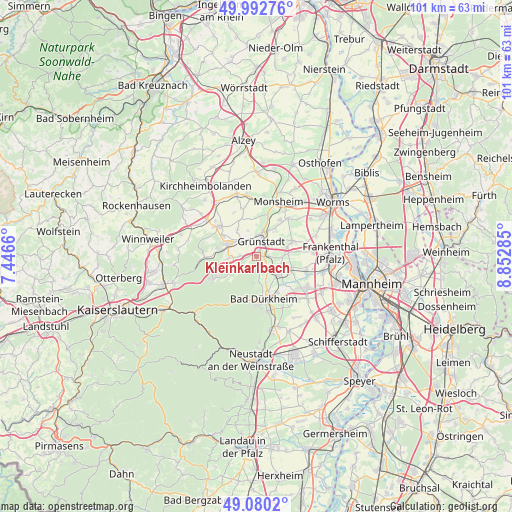
Kleinkarlbach GPS coordinates[2]
49° 32' 18.996" North, 8° 8' 58.992" East
| Map corner | latitude | longitude |
|---|---|---|
| Upper-left | 49.99276°, | 7.4466° |
| Center: | 49.53861°, | 8.14972° |
| Lower-right: | 49.0802°, | 8.85285° |
| Map W x H: | 101.5×101.5 km | = 63.1×63.1mi |
| max Lat: | 55.01917° ⇑75% North |
| Kleinkarlbach: | 49.53861° |
| min Lat: | ⇓25% South 47.40724° |
| min Long | Kleinkarlbach | max Long |
| 5.92978° | 8.14972° | 14.98853° |
| W 25.3%⇐ | ⇒74.7% E |
Elevation
Elevation of Kleinkarlbach is 182 m = 597 ft, and this is 67.1 m = 220 ft below average elevation for this country.
| Max E: |
1256 m = 4121 ft | 55.9% |
| Avg. | 249.1 m = 817 ft | |
| Kleinkarlbach | 182 m = 597 ft | |
Min E: |
-5 m = -16 ft | 44.1% |
See also: Germany elevation on elevation.city.
Geographical zone
Kleinkarlbach is located in North temperate zone (between Tropic of Cancer and the Arctic Circle). Distance of this North polar circle is 1893 km =1176.3 mi to North.| Distance of | km | miles | from Kleinkarlbach |
|---|---|---|---|
| North Pole | 4498.9 | 2795.5 | to North |
| Arctic Circle | 1893 | 1176.3 | to North |
| Tropic Cancer | 2902.3 | 1803.4 | to South |
| Equator | 5508.2 | 3422.6 | to South |


Nearby cities:
15 places around Kleinkarlbach: (largest is in red/bold)
• Bissersheim
3.9 km =2.4 mi,  94°
94°
• Bobenheim am Berg
1.6 km =1 mi,  176°
176°
• Dackenheim
3.3 km =2.1 mi,  125°
125°
• Ebertsheim
4.4 km =2.7 mi,  318°
318°
• Großkarlbach
5.4 km =3.4 mi, 90°
• Grünstadt
2.9 km =1.8 mi,  19°
19°
• Herxheim am Berg
3.9 km =2.4 mi,  147°
147°
• Kirchheim an der Weinstraße
2.3 km =1.4 mi, 93°
• Mertesheim
3.8 km =2.4 mi,  344°
344°
• Neuleiningen
0.9 km =0.6 mi,  293°
293°
• Obersülzen
5.5 km =3.4 mi,  53°
53°
• Quirnheim
5.4 km =3.4 mi, 341°
• Rodenbach
5 km =3.1 mi, 322°
• Tiefenthal
3.3 km =2.1 mi,  270°
270°
• Weisenheim am Berg
2.9 km =1.8 mi,  173°
173°
Sources, notices
• [Note1] Compared only with cities in Germany existing in our database
• [Src1] Map data: © OpenStreetMap contributors (CC-BY-SA)
• [Src2] Other city data from geonames.org with taken over terms of usage.
• [Src3] Geographical zone / Annual Mean Temperature by Robert A. Rohde @ Wikipedia
