Kiel geodata
Kiel (Schleswig-Holstein) is a seat of a first-order administrative division; located in Germany in Europe/Berlin (GMT+2) time zone. With population of 232,758 people, there are 38 cities with bigger population in this country. Compared to other cities in Germany, 96.5% of cities are located further ↓South; 52.3% of cities are located further ←West and 95.6% of cities have higher elevation than Kiel. Note1
Administrative division(s):
- Level 1: Schleswig-Holstein
- Level 3: Kreisfreie Stadt Kiel
- Level 4: Kiel, Landeshauptstadt


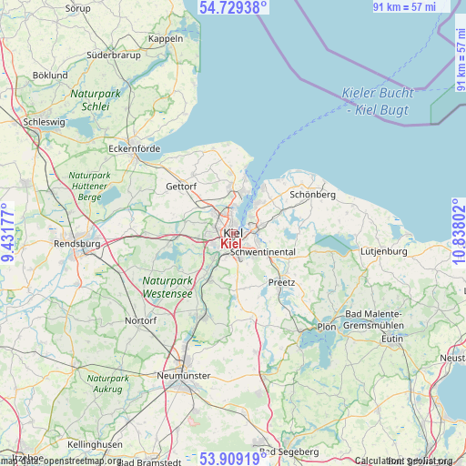
Kiel GPS coordinates[2]
54° 19' 16.788" North, 10° 8' 5.604" East
| Map corner | latitude | longitude |
|---|---|---|
| Upper-left | 54.72938°, | 9.43177° |
| Center: | 54.32133°, | 10.13489° |
| Lower-right: | 53.90919°, | 10.83802° |
| Map W x H: | 91.2×91.2 km | = 56.7×56.7mi |
| max Lat: | 55.01917° ⇑3.5% North |
| Kiel: | 54.32133° |
| min Lat: | ⇓96.5% South 47.40724° |
| min Long | Kiel | max Long |
| 5.92978° | 10.13489° | 14.98853° |
| W 52.3%⇐ | ⇒47.7% E |
Elevation
Elevation of Kiel is 7 m = 23 ft, and this is 242.1 m = 794 ft below average elevation for this country.
| Max E: |
1256 m = 4121 ft | 95.6% |
| Avg. | 249.1 m = 817 ft | |
| Kiel | 7 m = 23 ft | |
Min E: |
-5 m = -16 ft | 4.4% |
See also: Kiel elevation on elevation.city.
Geographical zone
Kiel is located in North temperate zone (between Tropic of Cancer and the Arctic Circle). Distance of this North polar circle is 1361.2 km =845.8 mi to North.| Distance of | km | miles | from Kiel |
|---|---|---|---|
| North Pole | 3967.1 | 2465 | to North |
| Arctic Circle | 1361.2 | 845.8 | to North |
| Tropic Cancer | 3434 | 2133.8 | to South |
| Equator | 6040 | 3753.1 | to South |


Nearby cities:
15 places around Kiel: (largest is in red/bold)
• Altenholz
8.7 km =5.4 mi,  359°
359°
• Dobersdorf
9.4 km =5.8 mi,  91°
91°
• Flintbek
9.1 km =5.7 mi,  209°
209°
• Heikendorf
6.6 km =4.1 mi,  39°
39°
• Klausdorf
5.3 km =3.3 mi,  105°
105°
• Kronshagen
3.6 km =2.2 mi,  291°
291°
• Melsdorf
6.6 km =4.1 mi,  265°
265°
• Mielkendorf
6.9 km =4.3 mi,  232°
232°
• Molfsee
7.5 km =4.7 mi,  216°
216°
• Mönkeberg
4.5 km =2.8 mi, 44°
• Neuwittenbek
9.2 km =5.7 mi,  303°
303°
• Ottendorf
6 km =3.7 mi, 291°
• Raisdorf
8.6 km =5.3 mi,  120°
120°
• Rodenbek
8.8 km =5.5 mi,  241°
241°
• Schönkirchen
6.5 km =4 mi,  78°
78°
Sources, notices
• [Note1] Compared only with cities in Germany existing in our database
• [Src1] Map data: © OpenStreetMap contributors (CC-BY-SA)
• [Src2] Other city data from geonames.org with taken over terms of usage.
• [Src3] Geographical zone / Annual Mean Temperature by Robert A. Rohde @ Wikipedia
