Kehmstedt geodata
Kehmstedt (Thuringia) is a seat of a fourth-order administrative division; located in Germany in Europe/Berlin (GMT+2) time zone. With population of 546 people, there are 9105 cities with bigger population in this country. Compared to other cities in Germany, 65.9% of cities are located further ↓South; 61% of cities are located further ←West and 52.2% of cities have lower elevation than Kehmstedt. Note1


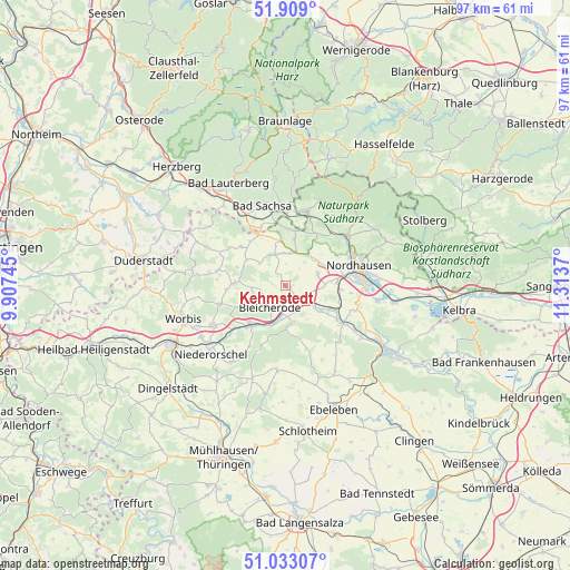
Kehmstedt GPS coordinates[2]
51° 28' 23.304" North, 10° 36' 38.052" East
| Map corner | latitude | longitude |
|---|---|---|
| Upper-left | 51.909°, | 9.90745° |
| Center: | 51.47314°, | 10.61057° |
| Lower-right: | 51.03307°, | 11.3137° |
| Map W x H: | 97.4×97.4 km | = 60.5×60.5mi |
| max Lat: | 55.01917° ⇑34.1% North |
| Kehmstedt: | 51.47314° |
| min Lat: | ⇓65.9% South 47.40724° |
| min Long | Kehmstedt | max Long |
| 5.92978° | 10.61057° | 14.98853° |
| W 61%⇐ | ⇒39% E |
Elevation
Elevation of Kehmstedt is 241 m = 791 ft, and this is 8.1 m = 27 ft below average elevation for this country.
| Max E: |
1256 m = 4121 ft | 47.8% |
| Avg. | 249.1 m = 817 ft | |
| Kehmstedt | 241 m = 791 ft | |
Min E: |
-5 m = -16 ft | 52.2% |
See also: Germany elevation on elevation.city.
Geographical zone
Kehmstedt is located in North temperate zone (between Tropic of Cancer and the Arctic Circle). Distance of this North polar circle is 1677.9 km =1042.6 mi to North.| Distance of | km | miles | from Kehmstedt |
|---|---|---|---|
| North Pole | 4283.8 | 2661.8 | to North |
| Arctic Circle | 1677.9 | 1042.6 | to North |
| Tropic Cancer | 3117.4 | 1937.1 | to South |
| Equator | 5723.3 | 3556.3 | to South |


Nearby cities:
15 places around Kehmstedt: (largest is in red/bold)
• Bleicherode
4.5 km =2.8 mi,  216°
216°
• Etzelsrode
3 km =1.9 mi,  8°
8°
• Friedrichsthal
2.2 km =1.4 mi,  300°
300°
• Großbodungen
9 km =5.6 mi,  271°
271°
• Kleinbodungen
5.4 km =3.4 mi,  262°
262°
• Kleinwenden
7.2 km =4.5 mi,  152°
152°
• Kraja
7 km =4.3 mi,  248°
248°
• Lipprechterode
4.3 km =2.7 mi, 246°
• Neustadt
9.9 km =6.2 mi, 266°
• Niedergebra
5.6 km =3.5 mi,  187°
187°
• Nohra
7.6 km =4.7 mi,  125°
125°
• Obergebra
7 km =4.3 mi,  197°
197°
• Sollstedt
8.3 km =5.2 mi, 220°
• Steinrode
8.8 km =5.5 mi,  291°
291°
• Wipperdorf
3 km =1.9 mi, 130°
Sources, notices
• [Note1] Compared only with cities in Germany existing in our database
• [Src1] Map data: © OpenStreetMap contributors (CC-BY-SA)
• [Src2] Other city data from geonames.org with taken over terms of usage.
• [Src3] Geographical zone / Annual Mean Temperature by Robert A. Rohde @ Wikipedia
