Ipsheim geodata
Ipsheim (Bavaria) is a populated place; located in Germany in Europe/Berlin (GMT+2) time zone. With population of 2,162 people, there are 4852 cities with bigger population in this country. Compared to other cities in Germany, 75.2% of cities are located further ↑North; 58.6% of cities are located further ←West and 62.8% of cities have lower elevation than Ipsheim. Note1
Administrative division(s):
- Level 1: Bavaria
- Level 2: Regierungsbezirk Mittelfranken
- Level 3: Landkreis Neustadt an der Aisch-Bad Windsheim
- Level 4: Ipsheim, Markt


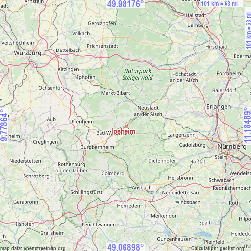
Ipsheim GPS coordinates[2]
49° 31' 39" North, 10° 28' 54.336" East
| Map corner | latitude | longitude |
|---|---|---|
| Upper-left | 49.98176°, | 9.77864° |
| Center: | 49.5275°, | 10.48176° |
| Lower-right: | 49.06898°, | 11.18489° |
| Map W x H: | 101.5×101.5 km | = 63.1×63.1mi |
| max Lat: | 55.01917° ⇑75.2% North |
| Ipsheim: | 49.5275° |
| min Lat: | ⇓24.8% South 47.40724° |
| min Long | Ipsheim | max Long |
| 5.92978° | 10.48176° | 14.98853° |
| W 58.6%⇐ | ⇒41.4% E |
Elevation
Elevation of Ipsheim is 307 m = 1007 ft, and this is 57.9 m = 190 ft above average elevation for this country.
| Max E: |
1256 m = 4121 ft | 37.2% |
| Ipsheim | 307 m 1007 ft | |
| Avg. | 249.1 m = 817 ft | |
Min E: |
-5 m = -16 ft | 62.8% |
See also: Germany elevation on elevation.city.
Geographical zone
Ipsheim is located in North temperate zone (between Tropic of Cancer and the Arctic Circle). Distance of this North polar circle is 1894.2 km =1177 mi to North.| Distance of | km | miles | from Ipsheim |
|---|---|---|---|
| North Pole | 4500.1 | 2796.2 | to North |
| Arctic Circle | 1894.2 | 1177 | to North |
| Tropic Cancer | 2901 | 1802.6 | to South |
| Equator | 5506.9 | 3421.8 | to South |


Nearby cities:
15 places around Ipsheim: (largest is in red/bold)
• Bad Windsheim
5.5 km =3.4 mi,  240°
240°
• Baudenbach
11.5 km =7.1 mi,  19°
19°
• Diespeck
13.6 km =8.5 mi,  53°
53°
• Dietersheim
5.3 km =3.3 mi, 53°
• Ergersheim
10.8 km =6.7 mi,  263°
263°
• Illesheim
8.9 km =5.5 mi,  233°
233°
• Langenfeld
10.2 km =6.3 mi,  14°
14°
• Markt Erlbach
12.9 km =8 mi,  106°
106°
• Markt Nordheim
11.5 km =7.1 mi,  307°
307°
• Marktbergel
12.8 km =8 mi,  221°
221°
• Neustadt an der Aisch
11 km =6.8 mi,  58°
58°
• Oberdachstetten
12.8 km =8 mi,  195°
195°
• Obernzenn
8.5 km =5.3 mi,  187°
187°
• Sugenheim
9 km =5.6 mi,  338°
338°
• Trautskirchen
11.2 km =7 mi,  133°
133°
Sources, notices
• [Note1] Compared only with cities in Germany existing in our database
• [Src1] Map data: © OpenStreetMap contributors (CC-BY-SA)
• [Src2] Other city data from geonames.org with taken over terms of usage.
• [Src3] Geographical zone / Annual Mean Temperature by Robert A. Rohde @ Wikipedia
