Illesheim geodata
Illesheim (Bavaria) is a seat of a fourth-order administrative division; located in Germany in Europe/Berlin (GMT+2) time zone. With population of 824 people, there are 7807 cities with bigger population in this country. Compared to other cities in Germany, 76.1% of cities are located further ↑North; 56.9% of cities are located further ←West and 65.2% of cities have lower elevation than Illesheim. Note1
Administrative division(s):
- Level 1: Bavaria
- Level 2: Regierungsbezirk Mittelfranken
- Level 3: Landkreis Neustadt an der Aisch-Bad Windsheim
- Level 4: Illesheim


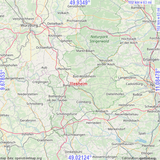
Illesheim GPS coordinates[2]
49° 28' 48.72" North, 10° 22' 53.94" East
| Map corner | latitude | longitude |
|---|---|---|
| Upper-left | 49.9349°, | 9.67853° |
| Center: | 49.4802°, | 10.38165° |
| Lower-right: | 49.02124°, | 11.08478° |
| Map W x H: | 101.6×101.6 km | = 63.1×63.1mi |
| max Lat: | 55.01917° ⇑76.1% North |
| Illesheim: | 49.4802° |
| min Lat: | ⇓23.9% South 47.40724° |
| min Long | Illesheim | max Long |
| 5.92978° | 10.38165° | 14.98853° |
| W 56.9%⇐ | ⇒43.1% E |
Elevation
Elevation of Illesheim is 323 m = 1060 ft, and this is 73.9 m = 242 ft above average elevation for this country.
| Max E: |
1256 m = 4121 ft | 34.8% |
| Illesheim | 323 m 1060 ft | |
| Avg. | 249.1 m = 817 ft | |
Min E: |
-5 m = -16 ft | 65.2% |
See also: Germany elevation on elevation.city.
Geographical zone
Illesheim is located in North temperate zone (between Tropic of Cancer and the Arctic Circle). Distance of this North polar circle is 1899.5 km =1180.3 mi to North.| Distance of | km | miles | from Illesheim |
|---|---|---|---|
| North Pole | 4505.4 | 2799.5 | to North |
| Arctic Circle | 1899.5 | 1180.3 | to North |
| Tropic Cancer | 2895.8 | 1799.4 | to South |
| Equator | 5501.7 | 3418.6 | to South |


Nearby cities:
15 places around Illesheim: (largest is in red/bold)
• Bad Windsheim
3.5 km =2.2 mi,  44°
44°
• Burgbernheim
5.3 km =3.3 mi,  232°
232°
• Ergersheim
5.3 km =3.3 mi,  319°
319°
• Flachslanden
13.2 km =8.2 mi,  133°
133°
• Gallmersgarten
9 km =5.6 mi,  247°
247°
• Geslau
13.5 km =8.4 mi,  200°
200°
• Ipsheim
8.9 km =5.5 mi,  53°
53°
• Markt Nordheim
12.5 km =7.8 mi,  351°
351°
• Marktbergel
4.5 km =2.8 mi, 196°
• Oberdachstetten
8 km =5 mi,  152°
152°
• Obernzenn
6.9 km =4.3 mi,  117°
117°
• Ohrenbach
12.4 km =7.7 mi,  265°
265°
• Uffenheim
12.9 km =8 mi,  303°
303°
• Weigenheim
13.6 km =8.5 mi, 321°
• Windelsbach
10.7 km =6.6 mi,  213°
213°
Sources, notices
• [Note1] Compared only with cities in Germany existing in our database
• [Src1] Map data: © OpenStreetMap contributors (CC-BY-SA)
• [Src2] Other city data from geonames.org with taken over terms of usage.
• [Src3] Geographical zone / Annual Mean Temperature by Robert A. Rohde @ Wikipedia
