Hutthurm geodata
Hutthurm (Bavaria) is a populated place; located in Germany in Europe/Berlin (GMT+2) time zone. With population of 5,950 people, there are 2475 cities with bigger population in this country. Compared to other cities in Germany, 86.8% of cities are located further ↑North; 95.6% of cities are located further ←West and 83.8% of cities have lower elevation than Hutthurm. Note1
Administrative division(s):
- Level 1: Bavaria
- Level 2: Lower Bavaria
- Level 3: Landkreis Passau
- Level 4: Hutthurm, Markt


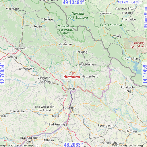
Hutthurm GPS coordinates[2]
48° 40' 21.936" North, 13° 28' 17.256" East
| Map corner | latitude | longitude |
|---|---|---|
| Upper-left | 49.13494°, | 12.76834° |
| Center: | 48.67276°, | 13.47146° |
| Lower-right: | 48.2063°, | 14.17459° |
| Map W x H: | 103.3×103.3 km | = 64.2×64.2mi |
| max Lat: | 55.01917° ⇑86.8% North |
| Hutthurm: | 48.67276° |
| min Lat: | ⇓13.2% South 47.40724° |
| min Long | Hutthurm | max Long |
| 5.92978° | 13.47146° | 14.98853° |
| W 95.6%⇐ | ⇒4.4% E |
Elevation
Elevation of Hutthurm is 460 m = 1509 ft, and this is 210.9 m = 692 ft above average elevation for this country.
| Max E: |
1256 m = 4121 ft | 16.2% |
| Hutthurm | 460 m 1509 ft | |
| Avg. | 249.1 m = 817 ft | |
Min E: |
-5 m = -16 ft | 83.8% |
See also: Germany elevation on elevation.city.
Geographical zone
Hutthurm is located in North temperate zone (between Tropic of Cancer and the Arctic Circle). Distance of this North polar circle is 1989.3 km =1236.1 mi to North.| Distance of | km | miles | from Hutthurm |
|---|---|---|---|
| North Pole | 4595.2 | 2855.3 | to North |
| Arctic Circle | 1989.3 | 1236.1 | to North |
| Tropic Cancer | 2806 | 1743.6 | to South |
| Equator | 5411.9 | 3362.8 | to South |


Nearby cities:
15 places around Hutthurm: (largest is in red/bold)
• Büchlberg
3.6 km =2.2 mi,  92°
92°
• Fürsteneck
4.9 km =3 mi,  355°
355°
• Fürstenstein
11.3 km =7 mi,  295°
295°
• Haselbach
6.7 km =4.2 mi,  243°
243°
• Hauzenberg
11.7 km =7.3 mi,  102°
102°
• Neukirchen vorm Wald
6.6 km =4.1 mi,  280°
280°
• Ruderting
4.8 km =3 mi, 237°
• Röhrnbach
8.2 km =5.1 mi,  27°
27°
• Salzweg
6.3 km =3.9 mi,  172°
172°
• Thyrnau
7.7 km =4.8 mi,  143°
143°
• Tiefenbach
7.5 km =4.7 mi,  224°
224°
• Tittling
8.8 km =5.5 mi,  312°
312°
• Waldkirchen
11.6 km =7.2 mi,  54°
54°
• Witzmannsberg
5.9 km =3.7 mi,  163°
163°
• Witzmannsberg
6.3 km =3.9 mi,  320°
320°
Sources, notices
• [Note1] Compared only with cities in Germany existing in our database
• [Src1] Map data: © OpenStreetMap contributors (CC-BY-SA)
• [Src2] Other city data from geonames.org with taken over terms of usage.
• [Src3] Geographical zone / Annual Mean Temperature by Robert A. Rohde @ Wikipedia
