Büchlberg geodata
Büchlberg (Bavaria) is a seat of a fourth-order administrative division; located in Germany in Europe/Berlin (GMT+2) time zone. With population of 3,984 people, there are 3312 cities with bigger population in this country. Compared to other cities in Germany, 86.9% of cities are located further ↑North; 95.9% of cities are located further ←West and 85.3% of cities have lower elevation than Büchlberg. Note1
Administrative division(s):
- Level 1: Bavaria
- Level 2: Lower Bavaria
- Level 3: Landkreis Passau
- Level 4: Büchlberg


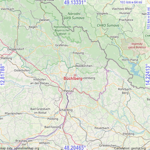
Büchlberg GPS coordinates[2]
48° 40' 16.032" North, 13° 31' 15.6" East
| Map corner | latitude | longitude |
|---|---|---|
| Upper-left | 49.13331°, | 12.81788° |
| Center: | 48.67112°, | 13.521° |
| Lower-right: | 48.20465°, | 14.22413° |
| Map W x H: | 103.3×103.3 km | = 64.2×64.2mi |
| max Lat: | 55.01917° ⇑86.9% North |
| Büchlberg: | 48.67112° |
| min Lat: | ⇓13.1% South 47.40724° |
| min Long | Büchlberg | max Long |
| 5.92978° | 13.521° | 14.98853° |
| W 95.9%⇐ | ⇒4.1% E |
Elevation
Elevation of Büchlberg is 472 m = 1549 ft, and this is 222.9 m = 731 ft above average elevation for this country.
| Max E: |
1256 m = 4121 ft | 14.7% |
| Büchlberg | 472 m 1549 ft | |
| Avg. | 249.1 m = 817 ft | |
Min E: |
-5 m = -16 ft | 85.3% |
See also: Germany elevation on elevation.city.
Geographical zone
Büchlberg is located in North temperate zone (between Tropic of Cancer and the Arctic Circle). Distance of this North polar circle is 1989.5 km =1236.2 mi to North.| Distance of | km | miles | from Büchlberg |
|---|---|---|---|
| North Pole | 4595.3 | 2855.4 | to North |
| Arctic Circle | 1989.5 | 1236.2 | to North |
| Tropic Cancer | 2805.8 | 1743.4 | to South |
| Equator | 5411.7 | 3362.7 | to South |


Nearby cities:
15 places around Büchlberg: (largest is in red/bold)
• Fürsteneck
6.4 km =4 mi,  321°
321°
• Haselbach
10.1 km =6.3 mi,  253°
253°
• Hauzenberg
8.1 km =5 mi,  107°
107°
• Hutthurm
3.6 km =2.2 mi,  272°
272°
• Neukirchen vorm Wald
10.2 km =6.3 mi,  277°
277°
• Passau
13.4 km =8.3 mi,  209°
209°
• Ruderting
8 km =5 mi, 252°
• Röhrnbach
7.5 km =4.7 mi,  0°
0°
• Salzweg
6.7 km =4.2 mi,  204°
204°
• Thyrnau
6.1 km =3.8 mi,  171°
171°
• Tiefenbach
10.3 km =6.4 mi,  239°
239°
• Tittling
11.9 km =7.4 mi,  301°
301°
• Waldkirchen
9 km =5.6 mi,  40°
40°
• Witzmannsberg
5.8 km =3.6 mi, 199°
• Witzmannsberg
9.2 km =5.7 mi, 303°
Sources, notices
• [Note1] Compared only with cities in Germany existing in our database
• [Src1] Map data: © OpenStreetMap contributors (CC-BY-SA)
• [Src2] Other city data from geonames.org with taken over terms of usage.
• [Src3] Geographical zone / Annual Mean Temperature by Robert A. Rohde @ Wikipedia
