Hauzenberg geodata
Hauzenberg (Bavaria) is a populated place; located in Germany in Europe/Berlin (GMT+2) time zone. With population of 12,522 people, there are 1294 cities with bigger population in this country. Compared to other cities in Germany, 87.2% of cities are located further ↑North; 96.5% of cities are located further ←West and 90.9% of cities have lower elevation than Hauzenberg. Note1
Administrative division(s):
- Level 1: Bavaria
- Level 2: Lower Bavaria
- Level 3: Landkreis Passau
- Level 4: Hauzenberg


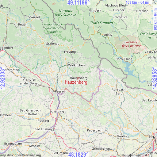
Hauzenberg GPS coordinates[2]
48° 38' 58.452" North, 13° 37' 35.22" East
| Map corner | latitude | longitude |
|---|---|---|
| Upper-left | 49.11196°, | 12.92333° |
| Center: | 48.64957°, | 13.62645° |
| Lower-right: | 48.1829°, | 14.32958° |
| Map W x H: | 103.3×103.3 km | = 64.2×64.2mi |
| max Lat: | 55.01917° ⇑87.2% North |
| Hauzenberg: | 48.64957° |
| min Lat: | ⇓12.8% South 47.40724° |
| min Long | Hauzenberg | max Long |
| 5.92978° | 13.62645° | 14.98853° |
| W 96.5%⇐ | ⇒3.5% E |
Elevation
Elevation of Hauzenberg is 526 m = 1726 ft, and this is 276.9 m = 908 ft above average elevation for this country.
| Max E: |
1256 m = 4121 ft | 9.1% |
| Hauzenberg | 526 m 1726 ft | |
| Avg. | 249.1 m = 817 ft | |
Min E: |
-5 m = -16 ft | 90.9% |
See also: Germany elevation on elevation.city.
Geographical zone
Hauzenberg is located in North temperate zone (between Tropic of Cancer and the Arctic Circle). Distance of this North polar circle is 1991.8 km =1237.6 mi to North.| Distance of | km | miles | from Hauzenberg |
|---|---|---|---|
| North Pole | 4597.7 | 2856.9 | to North |
| Arctic Circle | 1991.8 | 1237.6 | to North |
| Tropic Cancer | 2803.4 | 1742 | to South |
| Equator | 5409.3 | 3361.2 | to South |


Nearby cities:
15 places around Hauzenberg: (largest is in red/bold)
• Breitenberg
13.7 km =8.5 mi,  63°
63°
• Büchlberg
8.1 km =5 mi,  287°
287°
• Fürsteneck
13.9 km =8.6 mi,  302°
302°
• Hutthurm
11.7 km =7.3 mi,  282°
282°
• Jandelsbrunn
10.8 km =6.7 mi,  30°
30°
• Neureichenau
14.1 km =8.8 mi,  38°
38°
• Obernzell
10.6 km =6.6 mi,  175°
175°
• Röhrnbach
12.5 km =7.8 mi,  322°
322°
• Salzweg
11.1 km =6.9 mi,  250°
250°
• Sonnen
7.6 km =4.7 mi, 60°
• Thyrnau
7.8 km =4.8 mi,  241°
241°
• Untergriesbach
8.9 km =5.5 mi,  160°
160°
• Waldkirchen
9.4 km =5.8 mi,  348°
348°
• Wegscheid
13 km =8.1 mi,  114°
114°
• Witzmannsberg
10.2 km =6.3 mi, 252°
Sources, notices
• [Note1] Compared only with cities in Germany existing in our database
• [Src1] Map data: © OpenStreetMap contributors (CC-BY-SA)
• [Src2] Other city data from geonames.org with taken over terms of usage.
• [Src3] Geographical zone / Annual Mean Temperature by Robert A. Rohde @ Wikipedia
