Niederstaufenbach geodata
Niederstaufenbach (Rheinland-Pfalz) is a seat of a fourth-order administrative division; located in Germany in Europe/Berlin (GMT+2) time zone. With population of 290 people, there are 10096 cities with bigger population in this country. Compared to other cities in Germany, 75.2% of cities are located further ↑North; 86.8% of cities are located further →East and 64.7% of cities have lower elevation than Niederstaufenbach. Note1
Administrative division(s):
- Level 1: Rheinland-Pfalz
- Level 3: Landkreis Kusel
- Level 4: Niederstaufenbach


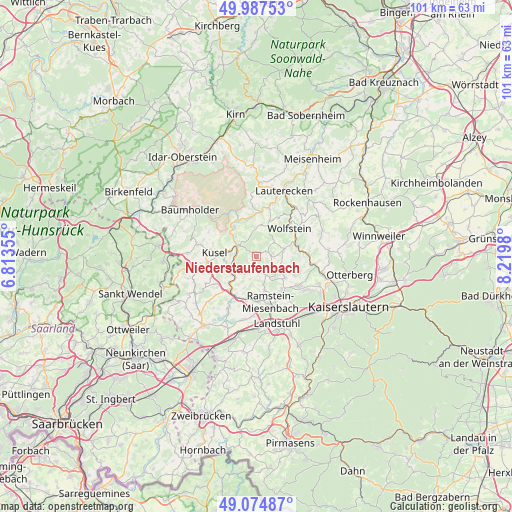
Niederstaufenbach GPS coordinates[2]
49° 31' 59.988" North, 7° 31' 0.012" East
| Map corner | latitude | longitude |
|---|---|---|
| Upper-left | 49.98753°, | 6.81355° |
| Center: | 49.53333°, | 7.51667° |
| Lower-right: | 49.07487°, | 8.2198° |
| Map W x H: | 101.5×101.5 km | = 63.1×63.1mi |
| max Lat: | 55.01917° ⇑75.2% North |
| Niederstaufenbach: | 49.53333° |
| min Lat: | ⇓24.8% South 47.40724° |
| min Long | Niederstaufenba | max Long |
| 5.92978° | 7.51667° | 14.98853° |
| W 13.2%⇐ | ⇒86.8% E |
Elevation
Elevation of Niederstaufenbach is 319 m = 1047 ft, and this is 69.9 m = 229 ft above average elevation for this country.
| Max E: |
1256 m = 4121 ft | 35.3% |
| Niederstaufenbach | 319 m 1047 ft | |
| Avg. | 249.1 m = 817 ft | |
Min E: |
-5 m = -16 ft | 64.7% |
See also: Germany elevation on elevation.city.
Geographical zone
Niederstaufenbach is located in North temperate zone (between Tropic of Cancer and the Arctic Circle). Distance of this North polar circle is 1893.6 km =1176.6 mi to North.| Distance of | km | miles | from Niederstaufenbach |
|---|---|---|---|
| North Pole | 4499.5 | 2795.9 | to North |
| Arctic Circle | 1893.6 | 1176.6 | to North |
| Tropic Cancer | 2901.7 | 1803 | to South |
| Equator | 5507.6 | 3422.3 | to South |


Nearby cities:
15 places around Niederstaufenbach: (largest is in red/bold)
• Altenglan
4.1 km =2.5 mi,  297°
297°
• Bosenbach
1.2 km =0.7 mi,  52°
52°
• Elzweiler
5.6 km =3.5 mi,  0°
0°
• Eßweiler
4.4 km =2.7 mi, 51°
• Föckelberg
2.4 km =1.5 mi,  270°
270°
• Horschbach
5.7 km =3.5 mi,  12°
12°
• Jettenbach
2.9 km =1.8 mi,  86°
86°
• Kollweiler
5.2 km =3.2 mi,  111°
111°
• Kottweiler-Schwanden
5.7 km =3.5 mi,  167°
167°
• Matzenbach
5.2 km =3.2 mi,  224°
224°
• Neunkirchen am Potzberg
4.4 km =2.7 mi,  213°
213°
• Oberstaufenbach
2 km =1.2 mi,  194°
194°
• Rammelsbach
5.3 km =3.3 mi,  280°
280°
• Reichenbach-Steegen
4.4 km =2.7 mi,  147°
147°
• Theisbergstegen
5.2 km =3.2 mi,  250°
250°
Sources, notices
• [Note1] Compared only with cities in Germany existing in our database
• [Src1] Map data: © OpenStreetMap contributors (CC-BY-SA)
• [Src2] Other city data from geonames.org with taken over terms of usage.
• [Src3] Geographical zone / Annual Mean Temperature by Robert A. Rohde @ Wikipedia
