Bosenbach geodata
Bosenbach (Rheinland-Pfalz) is a seat of a fourth-order administrative division; located in Germany in Europe/Berlin (GMT+2) time zone. With population of 846 people, there are 7722 cities with bigger population in this country. Compared to other cities in Germany, 74.9% of cities are located further ↑North; 86.4% of cities are located further →East and 55.3% of cities have lower elevation than Bosenbach. Note1


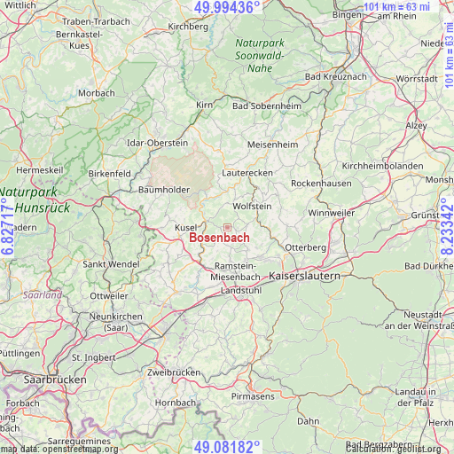
Bosenbach GPS coordinates[2]
49° 32' 24.792" North, 7° 31' 49.044" East
| Map corner | latitude | longitude |
|---|---|---|
| Upper-left | 49.99436°, | 6.82717° |
| Center: | 49.54022°, | 7.53029° |
| Lower-right: | 49.08182°, | 8.23342° |
| Map W x H: | 101.5×101.5 km | = 63.1×63.1mi |
| max Lat: | 55.01917° ⇑74.9% North |
| Bosenbach: | 49.54022° |
| min Lat: | ⇓25.1% South 47.40724° |
| min Long | Bosenbach | max Long |
| 5.92978° | 7.53029° | 14.98853° |
| W 13.6%⇐ | ⇒86.4% E |
Elevation
Elevation of Bosenbach is 260 m = 853 ft, and this is 10.9 m = 36 ft above average elevation for this country.
| Max E: |
1256 m = 4121 ft | 44.7% |
| Bosenbach | 260 m 853 ft | |
| Avg. | 249.1 m = 817 ft | |
Min E: |
-5 m = -16 ft | 55.3% |
See also: Germany elevation on elevation.city.
Geographical zone
Bosenbach is located in North temperate zone (between Tropic of Cancer and the Arctic Circle). Distance of this North polar circle is 1892.8 km =1176.1 mi to North.| Distance of | km | miles | from Bosenbach |
|---|---|---|---|
| North Pole | 4498.7 | 2795.4 | to North |
| Arctic Circle | 1892.8 | 1176.1 | to North |
| Tropic Cancer | 2902.4 | 1803.5 | to South |
| Equator | 5508.4 | 3422.8 | to South |


Nearby cities:
15 places around Bosenbach: (largest is in red/bold)
• Altenglan
4.7 km =2.9 mi,  283°
283°
• Elzweiler
4.9 km =3 mi,  348°
348°
• Eßweiler
3.2 km =2 mi,  50°
50°
• Föckelberg
3.5 km =2.2 mi,  257°
257°
• Hinzweiler
5 km =3.1 mi,  16°
16°
• Horschbach
4.8 km =3 mi,  2°
2°
• Jettenbach
2 km =1.2 mi,  107°
107°
• Kollweiler
4.6 km =2.9 mi,  124°
124°
• Neunkirchen am Potzberg
5.6 km =3.5 mi,  217°
217°
• Niederstaufenbach
1.2 km =0.7 mi,  232°
232°
• Oberstaufenbach
3.1 km =1.9 mi,  208°
208°
• Oberweiler im Tal
5 km =3.1 mi, 16°
• Reichenbach-Steegen
4.7 km =2.9 mi,  162°
162°
• Rothselberg
5.1 km =3.2 mi,  77°
77°
• Welchweiler
5.3 km =3.3 mi,  335°
335°
Sources, notices
• [Note1] Compared only with cities in Germany existing in our database
• [Src1] Map data: © OpenStreetMap contributors (CC-BY-SA)
• [Src2] Other city data from geonames.org with taken over terms of usage.
• [Src3] Geographical zone / Annual Mean Temperature by Robert A. Rohde @ Wikipedia
