Holldorf geodata
Holldorf (Mecklenburg-Vorpommern) is a populated place; located in Germany in Europe/Berlin (GMT+2) time zone. With population of 863 people, there are 7652 cities with bigger population in this country. Compared to other cities in Germany, 85.1% of cities are located further ↓South; 94.1% of cities are located further ←West and 69.2% of cities have higher elevation than Holldorf. Note1
Administrative division(s):
- Level 1: Mecklenburg-Vorpommern
- Level 3: Mecklenburgische Seenplatte
- Level 4: Holldorf


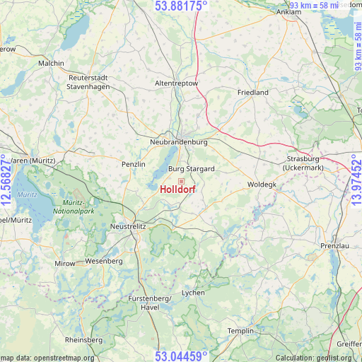
Holldorf GPS coordinates[2]
53° 27' 54.828" North, 13° 16' 17.004" East
| Map corner | latitude | longitude |
|---|---|---|
| Upper-left | 53.88175°, | 12.56827° |
| Center: | 53.46523°, | 13.27139° |
| Lower-right: | 53.04459°, | 13.97452° |
| Map W x H: | 93.1×93.1 km | = 57.8×57.8mi |
| max Lat: | 55.01917° ⇑14.9% North |
| Holldorf: | 53.46523° |
| min Lat: | ⇓85.1% South 47.40724° |
| min Long | Holldorf | max Long |
| 5.92978° | 13.27139° | 14.98853° |
| W 94.1%⇐ | ⇒5.9% E |
Elevation
Elevation of Holldorf is 96 m = 315 ft, and this is 153.1 m = 502 ft below average elevation for this country.
| Max E: |
1256 m = 4121 ft | 69.2% |
| Avg. | 249.1 m = 817 ft | |
| Holldorf | 96 m = 315 ft | |
Min E: |
-5 m = -16 ft | 30.8% |
See also: Germany elevation on elevation.city.
Geographical zone
Holldorf is located in North temperate zone (between Tropic of Cancer and the Arctic Circle). Distance of this North polar circle is 1456.4 km =905 mi to North.| Distance of | km | miles | from Holldorf |
|---|---|---|---|
| North Pole | 4062.3 | 2524.2 | to North |
| Arctic Circle | 1456.4 | 905 | to North |
| Tropic Cancer | 3338.9 | 2074.7 | to South |
| Equator | 5944.8 | 3693.9 | to South |


Nearby cities:
15 places around Holldorf: (largest is in red/bold)
• Blankensee
6.8 km =4.2 mi,  181°
181°
• Blumenholz
11.5 km =7.1 mi,  240°
240°
• Burg Stargard
4.3 km =2.7 mi,  37°
37°
• Carpin
12.2 km =7.6 mi,  188°
188°
• Cölpin
12.5 km =7.8 mi,  60°
60°
• Groß Nemerow
3.2 km =2 mi,  286°
286°
• Hohenzieritz
11.8 km =7.3 mi,  257°
257°
• Loitz
8.1 km =5 mi,  108°
108°
• Möllenbeck
9.6 km =6 mi,  150°
150°
• Neubrandenburg
11 km =6.8 mi,  1°
1°
• Penzlin
13.1 km =8.1 mi, 289°
• Pragsdorf
11.5 km =7.1 mi, 44°
• Teschendorf
5.8 km =3.6 mi,  98°
98°
• Wulkenzin
11.1 km =6.9 mi,  322°
322°
• Wustrow
7.8 km =4.8 mi,  280°
280°
Sources, notices
• [Note1] Compared only with cities in Germany existing in our database
• [Src1] Map data: © OpenStreetMap contributors (CC-BY-SA)
• [Src2] Other city data from geonames.org with taken over terms of usage.
• [Src3] Geographical zone / Annual Mean Temperature by Robert A. Rohde @ Wikipedia
