Heuthen geodata
Heuthen (Thuringia) is a seat of a fourth-order administrative division; located in Germany in Europe/Berlin (GMT+2) time zone. With population of 764 people, there are 8032 cities with bigger population in this country. Compared to other cities in Germany, 63.7% of cities are located further ↓South; 53.8% of cities are located further ←West and 76.1% of cities have lower elevation than Heuthen. Note1


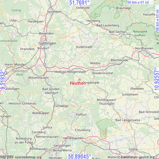
Heuthen GPS coordinates[2]
51° 19' 54.768" North, 10° 13' 20.784" East
| Map corner | latitude | longitude |
|---|---|---|
| Upper-left | 51.7691°, | 9.51932° |
| Center: | 51.33188°, | 10.22244° |
| Lower-right: | 50.89045°, | 10.92557° |
| Map W x H: | 97.7×97.7 km | = 60.7×60.7mi |
| max Lat: | 55.01917° ⇑36.3% North |
| Heuthen: | 51.33188° |
| min Lat: | ⇓63.7% South 47.40724° |
| min Long | Heuthen | max Long |
| 5.92978° | 10.22244° | 14.98853° |
| W 53.8%⇐ | ⇒46.2% E |
Elevation
Elevation of Heuthen is 406 m = 1332 ft, and this is 156.9 m = 515 ft above average elevation for this country.
| Max E: |
1256 m = 4121 ft | 23.9% |
| Heuthen | 406 m 1332 ft | |
| Avg. | 249.1 m = 817 ft | |
Min E: |
-5 m = -16 ft | 76.1% |
See also: Germany elevation on elevation.city.
Geographical zone
Heuthen is located in North temperate zone (between Tropic of Cancer and the Arctic Circle). Distance of this North polar circle is 1693.6 km =1052.4 mi to North.| Distance of | km | miles | from Heuthen |
|---|---|---|---|
| North Pole | 4299.5 | 2671.6 | to North |
| Arctic Circle | 1693.6 | 1052.4 | to North |
| Tropic Cancer | 3101.7 | 1927.3 | to South |
| Equator | 5707.6 | 3546.5 | to South |


Nearby cities:
15 places around Heuthen: (largest is in red/bold)
• Dieterode
9.2 km =5.7 mi,  247°
247°
• Dingelstädt
6.9 km =4.3 mi,  105°
105°
• Ershausen
9.3 km =5.8 mi,  207°
207°
• Geisleden
2.5 km =1.6 mi,  322°
322°
• Großbartloff
9.1 km =5.7 mi,  182°
182°
• Heilbad Heiligenstadt
7.8 km =4.8 mi,  311°
311°
• Kallmerode
5.8 km =3.6 mi,  69°
69°
• Kefferhausen
4.6 km =2.9 mi, 111°
• Kreuzebra
2.8 km =1.7 mi,  43°
43°
• Krombach
7.1 km =4.4 mi,  240°
240°
• Küllstedt
7.4 km =4.6 mi,  147°
147°
• Lutter
7.3 km =4.5 mi,  271°
271°
• Silberhausen
8.5 km =5.3 mi, 106°
• Wachstedt
4 km =2.5 mi, 151°
• Wingerode
6.6 km =4.1 mi,  10°
10°
Sources, notices
• [Note1] Compared only with cities in Germany existing in our database
• [Src1] Map data: © OpenStreetMap contributors (CC-BY-SA)
• [Src2] Other city data from geonames.org with taken over terms of usage.
• [Src3] Geographical zone / Annual Mean Temperature by Robert A. Rohde @ Wikipedia
