Herxheimweyher geodata
Herxheimweyher (Rheinland-Pfalz) is a seat of a fourth-order administrative division; located in Germany in Europe/Berlin (GMT+2) time zone. With population of 468 people, there are 9480 cities with bigger population in this country. Compared to other cities in Germany, 81.1% of cities are located further ↑North; 73.4% of cities are located further →East and 65.4% of cities have higher elevation than Herxheimweyher. Note1
Administrative division(s):
- Level 1: Rheinland-Pfalz
- Level 3: Landkreis Südliche Weinstraße
- Level 4: Herxheimweyher


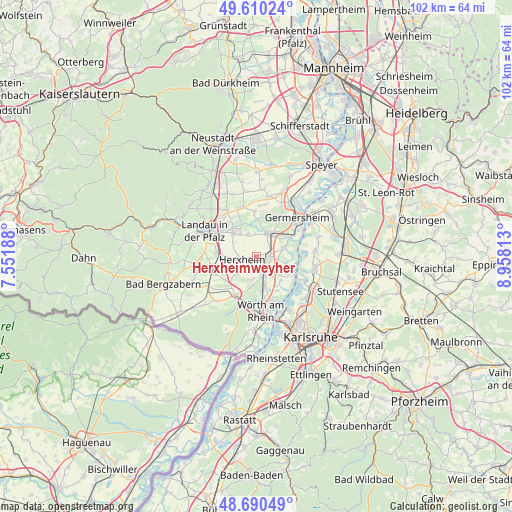
Herxheimweyher GPS coordinates[2]
49° 9' 9" North, 8° 15' 18" East
| Map corner | latitude | longitude |
|---|---|---|
| Upper-left | 49.61024°, | 7.55188° |
| Center: | 49.1525°, | 8.255° |
| Lower-right: | 48.69049°, | 8.95813° |
| Map W x H: | 102.3×102.3 km | = 63.6×63.6mi |
| max Lat: | 55.01917° ⇑81.1% North |
| Herxheimweyher: | 49.1525° |
| min Lat: | ⇓18.9% South 47.40724° |
| min Long | Herxheimweyher | max Long |
| 5.92978° | 8.255° | 14.98853° |
| W 26.6%⇐ | ⇒73.4% E |
Elevation
Elevation of Herxheimweyher is 118 m = 387 ft, and this is 131.1 m = 430 ft below average elevation for this country.
| Max E: |
1256 m = 4121 ft | 65.4% |
| Avg. | 249.1 m = 817 ft | |
| Herxheimweyher | 118 m = 387 ft | |
Min E: |
-5 m = -16 ft | 34.6% |
See also: Germany elevation on elevation.city.
Geographical zone
Herxheimweyher is located in North temperate zone (between Tropic of Cancer and the Arctic Circle). Distance of this North polar circle is 1935.9 km =1202.9 mi to North.| Distance of | km | miles | from Herxheimweyher |
|---|---|---|---|
| North Pole | 4541.8 | 2822.1 | to North |
| Arctic Circle | 1935.9 | 1202.9 | to North |
| Tropic Cancer | 2859.3 | 1776.7 | to South |
| Equator | 5465.2 | 3395.9 | to South |


Nearby cities:
15 places around Herxheimweyher: (largest is in red/bold)
• Bellheim
5.4 km =3.4 mi,  19°
19°
• Erlenbach
6.8 km =4.2 mi,  226°
226°
• Hatzenbühl
4.7 km =2.9 mi,  188°
188°
• Herxheim
3.1 km =1.9 mi,  257°
257°
• Hördt
5.4 km =3.4 mi,  74°
74°
• Insheim
7.9 km =4.9 mi,  274°
274°
• Jockgrim
6.8 km =4.2 mi,  167°
167°
• Knittelsheim
4.4 km =2.7 mi,  356°
356°
• Kuhardt
4.4 km =2.7 mi,  99°
99°
• Leimersheim
7.3 km =4.5 mi,  115°
115°
• Neupotz
6.1 km =3.8 mi,  129°
129°
• Offenbach an der Queich
6.3 km =3.9 mi,  318°
318°
• Ottersheim
4.6 km =2.9 mi,  338°
338°
• Rheinzabern
4.2 km =2.6 mi,  156°
156°
• Rülzheim
2.8 km =1.7 mi,  88°
88°
Sources, notices
• [Note1] Compared only with cities in Germany existing in our database
• [Src1] Map data: © OpenStreetMap contributors (CC-BY-SA)
• [Src2] Other city data from geonames.org with taken over terms of usage.
• [Src3] Geographical zone / Annual Mean Temperature by Robert A. Rohde @ Wikipedia
