Hemdingen geodata
Hemdingen (Schleswig-Holstein) is a seat of a fourth-order administrative division; located in Germany in Europe/Berlin (GMT+2) time zone. With population of 1,700 people, there are 5512 cities with bigger population in this country. Compared to other cities in Germany, 89.5% of cities are located further ↓South; 52.4% of cities are located further →East and 91.6% of cities have higher elevation than Hemdingen. Note1


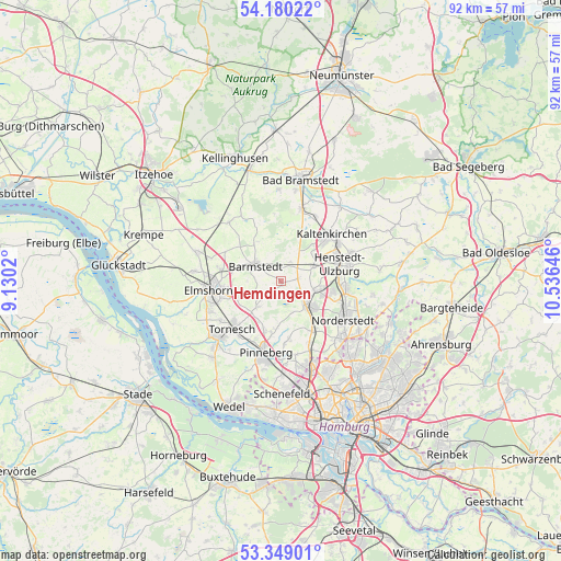
Hemdingen GPS coordinates[2]
53° 46' 0.012" North, 9° 49' 59.988" East
| Map corner | latitude | longitude |
|---|---|---|
| Upper-left | 54.18022°, | 9.1302° |
| Center: | 53.76667°, | 9.83333° |
| Lower-right: | 53.34901°, | 10.53646° |
| Map W x H: | 92.4×92.4 km | = 57.4×57.4mi |
| max Lat: | 55.01917° ⇑10.5% North |
| Hemdingen: | 53.76667° |
| min Lat: | ⇓89.5% South 47.40724° |
| min Long | Hemdingen | max Long |
| 5.92978° | 9.83333° | 14.98853° |
| W 47.6%⇐ | ⇒52.4% E |
Elevation
Elevation of Hemdingen is 17 m = 56 ft, and this is 232.1 m = 761 ft below average elevation for this country.
| Max E: |
1256 m = 4121 ft | 91.6% |
| Avg. | 249.1 m = 817 ft | |
| Hemdingen | 17 m = 56 ft | |
Min E: |
-5 m = -16 ft | 8.4% |
See also: Germany elevation on elevation.city.
Geographical zone
Hemdingen is located in North temperate zone (between Tropic of Cancer and the Arctic Circle). Distance of this North polar circle is 1422.9 km =884.1 mi to North.| Distance of | km | miles | from Hemdingen |
|---|---|---|---|
| North Pole | 4028.8 | 2503.4 | to North |
| Arctic Circle | 1422.9 | 884.1 | to North |
| Tropic Cancer | 3372.4 | 2095.5 | to South |
| Equator | 5978.3 | 3714.7 | to South |


Nearby cities:
15 places around Hemdingen: (largest is in red/bold)
• Alveslohe
5.8 km =3.6 mi,  71°
71°
• Barmstedt
5.2 km =3.2 mi,  303°
303°
• Bevern
4.3 km =2.7 mi,  253°
253°
• Bilsen
3.3 km =2.1 mi,  90°
90°
• Bokholt-Hanredder
6.8 km =4.2 mi,  290°
290°
• Bullenkuhlen
5.5 km =3.4 mi,  270°
270°
• Ellerau
5.8 km =3.6 mi,  108°
108°
• Ellerhoop
6.2 km =3.9 mi,  222°
222°
• Heede
2.9 km =1.8 mi,  310°
310°
• Heidmoor
7.5 km =4.7 mi,  8°
8°
• Langeln
3.5 km =2.2 mi,  33°
33°
• Lutzhorn
7.7 km =4.8 mi,  326°
326°
• Quickborn
6.6 km =4.1 mi,  130°
130°
• Seeth
7.7 km =4.8 mi,  240°
240°
• Seeth-Ekholt
7.4 km =4.6 mi, 247°
Sources, notices
• [Note1] Compared only with cities in Germany existing in our database
• [Src1] Map data: © OpenStreetMap contributors (CC-BY-SA)
• [Src2] Other city data from geonames.org with taken over terms of usage.
• [Src3] Geographical zone / Annual Mean Temperature by Robert A. Rohde @ Wikipedia
