Heidmoor geodata
Heidmoor (Schleswig-Holstein) is a seat of a fourth-order administrative division; located in Germany in Europe/Berlin (GMT+2) time zone. With population of 330 people, there are 9947 cities with bigger population in this country. Compared to other cities in Germany, 90.4% of cities are located further ↓South; 52.2% of cities are located further →East and 87.7% of cities have higher elevation than Heidmoor. Note1


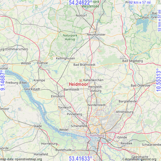
Heidmoor GPS coordinates[2]
53° 49' 59.988" North, 9° 51' 0" East
| Map corner | latitude | longitude |
|---|---|---|
| Upper-left | 54.24622°, | 9.14687° |
| Center: | 53.83333°, | 9.85° |
| Lower-right: | 53.41633°, | 10.55313° |
| Map W x H: | 92.3×92.3 km | = 57.4×57.4mi |
| max Lat: | 55.01917° ⇑9.6% North |
| Heidmoor: | 53.83333° |
| min Lat: | ⇓90.4% South 47.40724° |
| min Long | Heidmoor | max Long |
| 5.92978° | 9.85° | 14.98853° |
| W 47.8%⇐ | ⇒52.2% E |
Elevation
Elevation of Heidmoor is 28 m = 92 ft, and this is 221.1 m = 725 ft below average elevation for this country.
| Max E: |
1256 m = 4121 ft | 87.7% |
| Avg. | 249.1 m = 817 ft | |
| Heidmoor | 28 m = 92 ft | |
Min E: |
-5 m = -16 ft | 12.3% |
See also: Germany elevation on elevation.city.
Geographical zone
Heidmoor is located in North temperate zone (between Tropic of Cancer and the Arctic Circle). Distance of this North polar circle is 1415.5 km =879.6 mi to North.| Distance of | km | miles | from Heidmoor |
|---|---|---|---|
| North Pole | 4021.4 | 2498.8 | to North |
| Arctic Circle | 1415.5 | 879.6 | to North |
| Tropic Cancer | 3379.8 | 2100.1 | to South |
| Equator | 5985.7 | 3719.3 | to South |


Nearby cities:
15 places around Heidmoor: (largest is in red/bold)
• Alveslohe
7.1 km =4.4 mi,  141°
141°
• Barmstedt
7.1 km =4.4 mi,  229°
229°
• Bilsen
7.7 km =4.8 mi,  163°
163°
• Bokel
8.5 km =5.3 mi,  295°
295°
• Groß Offenseth-Aspern
7.9 km =4.9 mi,  256°
256°
• Heede
6.5 km =4 mi,  210°
210°
• Hemdingen
7.5 km =4.7 mi,  188°
188°
• Kaltenkirchen
7.1 km =4.4 mi,  90°
90°
• Kampen
6.1 km =3.8 mi,  66°
66°
• Langeln
4.6 km =2.9 mi,  169°
169°
• Lentföhrden
4.3 km =2.7 mi,  30°
30°
• Lutzhorn
5.4 km =3.4 mi, 260°
• Mönkloh
7.5 km =4.7 mi,  327°
327°
• Nützen
5.7 km =3.5 mi,  49°
49°
• Weddelbrook
7.5 km =4.7 mi,  351°
351°
Sources, notices
• [Note1] Compared only with cities in Germany existing in our database
• [Src1] Map data: © OpenStreetMap contributors (CC-BY-SA)
• [Src2] Other city data from geonames.org with taken over terms of usage.
• [Src3] Geographical zone / Annual Mean Temperature by Robert A. Rohde @ Wikipedia
