Heinrichsthal geodata
Heinrichsthal (Bavaria) is a seat of a fourth-order administrative division; located in Germany in Europe/Berlin (GMT+2) time zone. With population of 918 people, there are 7463 cities with bigger population in this country. Compared to other cities in Germany, 61.9% of cities are located further ↑North; 60.2% of cities are located further →East and 79.9% of cities have lower elevation than Heinrichsthal. Note1
Administrative division(s):
- Level 1: Bavaria
- Level 2: Regierungsbezirk Unterfranken
- Level 3: Landkreis Aschaffenburg
- Level 4: Heinrichsthal


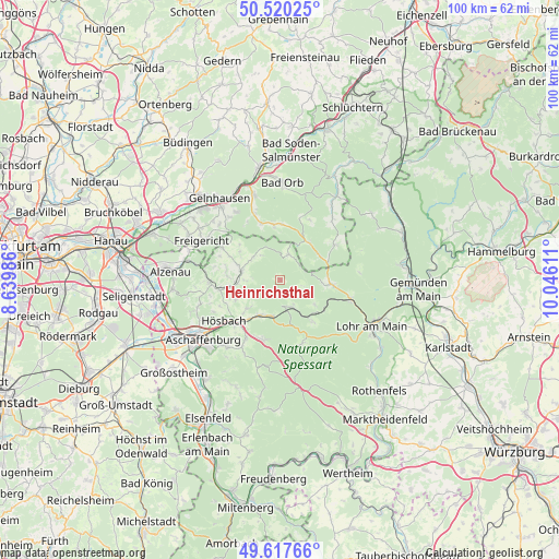
Heinrichsthal GPS coordinates[2]
50° 4' 15.888" North, 9° 20' 34.728" East
| Map corner | latitude | longitude |
|---|---|---|
| Upper-left | 50.52025°, | 8.63986° |
| Center: | 50.07108°, | 9.34298° |
| Lower-right: | 49.61766°, | 10.04611° |
| Map W x H: | 100.4×100.4 km | = 62.4×62.4mi |
| max Lat: | 55.01917° ⇑61.9% North |
| Heinrichsthal: | 50.07108° |
| min Lat: | ⇓38.1% South 47.40724° |
| min Long | Heinrichsthal | max Long |
| 5.92978° | 9.34298° | 14.98853° |
| W 39.8%⇐ | ⇒60.2% E |
Elevation
Elevation of Heinrichsthal is 432 m = 1417 ft, and this is 182.9 m = 600 ft above average elevation for this country.
| Max E: |
1256 m = 4121 ft | 20.1% |
| Heinrichsthal | 432 m 1417 ft | |
| Avg. | 249.1 m = 817 ft | |
Min E: |
-5 m = -16 ft | 79.9% |
See also: Germany elevation on elevation.city.
Geographical zone
Heinrichsthal is located in North temperate zone (between Tropic of Cancer and the Arctic Circle). Distance of this North polar circle is 1833.8 km =1139.5 mi to North.| Distance of | km | miles | from Heinrichsthal |
|---|---|---|---|
| North Pole | 4439.7 | 2758.7 | to North |
| Arctic Circle | 1833.8 | 1139.5 | to North |
| Tropic Cancer | 2961.5 | 1840.2 | to South |
| Equator | 5567.4 | 3459.4 | to South |


Nearby cities:
15 places around Heinrichsthal: (largest is in red/bold)
• Blankenbach
7.8 km =4.8 mi,  266°
266°
• Frammersbach
9 km =5.6 mi,  94°
94°
• Geiselbach
11.9 km =7.4 mi,  299°
299°
• Heigenbrücken
5.2 km =3.2 mi,  157°
157°
• Hösbach
12 km =7.5 mi,  233°
233°
• Kleinkahl
7.4 km =4.6 mi,  312°
312°
• Krombach
9.9 km =6.2 mi,  277°
277°
• Laufach
6.8 km =4.2 mi,  206°
206°
• Neuhütten
9.5 km =5.9 mi,  146°
146°
• Sailauf
7.9 km =4.9 mi, 229°
• Schöllkrippen
7 km =4.3 mi, 283°
• Sommerkahl
6.2 km =3.9 mi, 268°
• Waldaschaff
11 km =6.8 mi,  195°
195°
• Wiesen
5.3 km =3.3 mi,  18°
18°
• Wiesthal
7.7 km =4.8 mi,  123°
123°
Sources, notices
• [Note1] Compared only with cities in Germany existing in our database
• [Src1] Map data: © OpenStreetMap contributors (CC-BY-SA)
• [Src2] Other city data from geonames.org with taken over terms of usage.
• [Src3] Geographical zone / Annual Mean Temperature by Robert A. Rohde @ Wikipedia
