Heiligenstedten geodata
Heiligenstedten (Schleswig-Holstein) is a seat of a fourth-order administrative division; located in Germany in Europe/Berlin (GMT+2) time zone. With population of 1,724 people, there are 5467 cities with bigger population in this country. Compared to other cities in Germany, 91.7% of cities are located further ↓South; 58.2% of cities are located further →East and 99.1% of cities have higher elevation than Heiligenstedten. Note1
Administrative division(s):
- Level 1: Schleswig-Holstein
- Level 3: Kreis Steinburg
- Level 4: Heiligenstedten


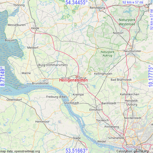
Heiligenstedten GPS coordinates[2]
53° 55' 57.504" North, 9° 28' 28.632" East
| Map corner | latitude | longitude |
|---|---|---|
| Upper-left | 54.34455°, | 8.77149° |
| Center: | 53.93264°, | 9.47462° |
| Lower-right: | 53.51663°, | 10.17775° |
| Map W x H: | 92.1×92.1 km | = 57.2×57.2mi |
| max Lat: | 55.01917° ⇑8.3% North |
| Heiligenstedten: | 53.93264° |
| min Lat: | ⇓91.7% South 47.40724° |
| min Long | Heiligenstedten | max Long |
| 5.92978° | 9.47462° | 14.98853° |
| W 41.8%⇐ | ⇒58.2% E |
Elevation
Elevation of Heiligenstedten is 0 m = 0 ft, and this is 249.1 m = 817 ft below average elevation for this country.
| Max E: |
1256 m = 4121 ft | 99.1% |
| Avg. | 249.1 m = 817 ft | |
| Heiligenstedten | 0 m = 0 ft | |
Min E: |
-5 m = -16 ft | 0.9% |
See also: Germany elevation on elevation.city.
Geographical zone
Heiligenstedten is located in North temperate zone (between Tropic of Cancer and the Arctic Circle). Distance of this North polar circle is 1404.4 km =872.7 mi to North.| Distance of | km | miles | from Heiligenstedten |
|---|---|---|---|
| North Pole | 4010.3 | 2491.9 | to North |
| Arctic Circle | 1404.4 | 872.7 | to North |
| Tropic Cancer | 3390.8 | 2106.9 | to South |
| Equator | 5996.7 | 3726.2 | to South |


Nearby cities:
15 places around Heiligenstedten: (largest is in red/bold)
• Bekdorf
3.5 km =2.2 mi,  282°
282°
• Bekmünde
2 km =1.2 mi,  245°
245°
• Heiligenstedtenerkamp
3.7 km =2.3 mi,  186°
186°
• Hodorf
4.6 km =2.9 mi,  219°
219°
• Huje
5.6 km =3.5 mi,  332°
332°
• Itzehoe
3 km =1.9 mi,  115°
115°
• Kleve
6.2 km =3.9 mi,  307°
307°
• Kremperheide
5.1 km =3.2 mi,  177°
177°
• Krempermoor
6.2 km =3.9 mi, 176°
• Krummendiek
4.1 km =2.5 mi,  292°
292°
• Münsterdorf
5.5 km =3.4 mi,  127°
127°
• Oelixdorf
5.9 km =3.7 mi,  95°
95°
• Oldendorf
2.5 km =1.6 mi,  335°
335°
• Ottenbüttel
4.7 km =2.9 mi,  24°
24°
• Stördorf
3.7 km =2.3 mi,  238°
238°
Sources, notices
• [Note1] Compared only with cities in Germany existing in our database
• [Src1] Map data: © OpenStreetMap contributors (CC-BY-SA)
• [Src2] Other city data from geonames.org with taken over terms of usage.
• [Src3] Geographical zone / Annual Mean Temperature by Robert A. Rohde @ Wikipedia
