Ottenbüttel geodata
Ottenbüttel (Schleswig-Holstein) is a seat of a fourth-order administrative division; located in Germany in Europe/Berlin (GMT+2) time zone. With population of 746 people, there are 8119 cities with bigger population in this country. Compared to other cities in Germany, 92.3% of cities are located further ↓South; 57.7% of cities are located further →East and 93.5% of cities have higher elevation than Ottenbüttel. Note1
Administrative division(s):
- Level 1: Schleswig-Holstein
- Level 3: Kreis Steinburg
- Level 4: Ottenbüttel


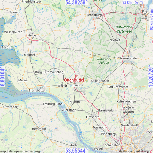
Ottenbüttel GPS coordinates[2]
53° 58' 15.852" North, 9° 30' 14.976" East
| Map corner | latitude | longitude |
|---|---|---|
| Upper-left | 54.38259°, | 8.80104° |
| Center: | 53.97107°, | 9.50416° |
| Lower-right: | 53.55544°, | 10.20729° |
| Map W x H: | 92×92 km | = 57.2×57.2mi |
| max Lat: | 55.01917° ⇑7.7% North |
| Ottenbüttel: | 53.97107° |
| min Lat: | ⇓92.3% South 47.40724° |
| min Long | Ottenbüttel | max Long |
| 5.92978° | 9.50416° | 14.98853° |
| W 42.3%⇐ | ⇒57.7% E |
Elevation
Elevation of Ottenbüttel is 12 m = 39 ft, and this is 237.1 m = 778 ft below average elevation for this country.
| Max E: |
1256 m = 4121 ft | 93.5% |
| Avg. | 249.1 m = 817 ft | |
| Ottenbüttel | 12 m = 39 ft | |
Min E: |
-5 m = -16 ft | 6.5% |
See also: Germany elevation on elevation.city.
Geographical zone
Ottenbüttel is located in North temperate zone (between Tropic of Cancer and the Arctic Circle). Distance of this North polar circle is 1400.2 km =870 mi to North.| Distance of | km | miles | from Ottenbüttel |
|---|---|---|---|
| North Pole | 4006 | 2489.2 | to North |
| Arctic Circle | 1400.2 | 870 | to North |
| Tropic Cancer | 3395.1 | 2109.6 | to South |
| Equator | 6001 | 3728.8 | to South |


Nearby cities:
15 places around Ottenbüttel: (largest is in red/bold)
• Bekdorf
6.4 km =4 mi,  236°
236°
• Bekmünde
6.4 km =4 mi,  216°
216°
• Drage
3.8 km =2.4 mi,  15°
15°
• Heiligenstedten
4.7 km =2.9 mi,  204°
204°
• Hohenaspe
2.5 km =1.6 mi,  37°
37°
• Huje
4.6 km =2.9 mi,  278°
278°
• Itzehoe
5.6 km =3.5 mi,  172°
172°
• Kaaks
3.1 km =1.9 mi,  313°
313°
• Kaisborstel
5 km =3.1 mi,  342°
342°
• Krummendiek
6.3 km =3.9 mi, 244°
• Looft
6.5 km =4 mi,  11°
11°
• Mehlbek
5.9 km =3.7 mi, 309°
• Oelixdorf
6.2 km =3.9 mi,  141°
141°
• Oldendorf
3.6 km =2.2 mi, 236°
• Schlotfeld
5.4 km =3.4 mi,  107°
107°
Sources, notices
• [Note1] Compared only with cities in Germany existing in our database
• [Src1] Map data: © OpenStreetMap contributors (CC-BY-SA)
• [Src2] Other city data from geonames.org with taken over terms of usage.
• [Src3] Geographical zone / Annual Mean Temperature by Robert A. Rohde @ Wikipedia
