Heeslingen geodata
Heeslingen (Lower Saxony) is a seat of a fourth-order administrative division; located in Germany in Europe/Berlin (GMT+2) time zone. With population of 4,803 people, there are 2901 cities with bigger population in this country. Compared to other cities in Germany, 83.8% of cities are located further ↓South; 60.3% of cities are located further →East and 90.5% of cities have higher elevation than Heeslingen. Note1


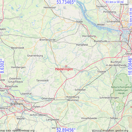
Heeslingen GPS coordinates[2]
53° 19' 0.012" North, 9° 19' 59.988" East
| Map corner | latitude | longitude |
|---|---|---|
| Upper-left | 53.73465°, | 8.6302° |
| Center: | 53.31667°, | 9.33333° |
| Lower-right: | 52.89456°, | 10.03646° |
| Map W x H: | 93.4×93.4 km | = 58×58mi |
| max Lat: | 55.01917° ⇑16.2% North |
| Heeslingen: | 53.31667° |
| min Lat: | ⇓83.8% South 47.40724° |
| min Long | Heeslingen | max Long |
| 5.92978° | 9.33333° | 14.98853° |
| W 39.7%⇐ | ⇒60.3% E |
Elevation
Elevation of Heeslingen is 20 m = 66 ft, and this is 229.1 m = 752 ft below average elevation for this country.
| Max E: |
1256 m = 4121 ft | 90.5% |
| Avg. | 249.1 m = 817 ft | |
| Heeslingen | 20 m = 66 ft | |
Min E: |
-5 m = -16 ft | 9.5% |
See also: Germany elevation on elevation.city.
Geographical zone
Heeslingen is located in North temperate zone (between Tropic of Cancer and the Arctic Circle). Distance of this North polar circle is 1472.9 km =915.2 mi to North.| Distance of | km | miles | from Heeslingen |
|---|---|---|---|
| North Pole | 4078.8 | 2534.4 | to North |
| Arctic Circle | 1472.9 | 915.2 | to North |
| Tropic Cancer | 3322.3 | 2064.4 | to South |
| Equator | 5928.3 | 3683.7 | to South |


Nearby cities:
15 places around Heeslingen: (largest is in red/bold)
• Ahlerstedt
12.1 km =7.5 mi,  39°
39°
• Anderlingen
6.7 km =4.2 mi,  342°
342°
• Deinstedt
12.9 km =8 mi,  329°
329°
• Elsdorf
8.5 km =5.3 mi,  172°
172°
• Groß Meckelsen
8.6 km =5.3 mi,  115°
115°
• Gyhum
11.2 km =7 mi,  185°
185°
• Hamersen
11.9 km =7.4 mi, 124°
• Klein Meckelsen
8 km =5 mi,  103°
103°
• Lengenbostel
12.3 km =7.6 mi, 98°
• Ostereistedt
11.2 km =7 mi,  260°
260°
• Seedorf
7.6 km =4.7 mi,  299°
299°
• Selsingen
10.2 km =6.3 mi,  308°
308°
• Sittensen
12.2 km =7.6 mi,  111°
111°
• Vierden
11.2 km =7 mi,  80°
80°
• Zeven
4.4 km =2.7 mi,  239°
239°
Sources, notices
• [Note1] Compared only with cities in Germany existing in our database
• [Src1] Map data: © OpenStreetMap contributors (CC-BY-SA)
• [Src2] Other city data from geonames.org with taken over terms of usage.
• [Src3] Geographical zone / Annual Mean Temperature by Robert A. Rohde @ Wikipedia
