Seedorf geodata
Seedorf (Lower Saxony) is a seat of a fourth-order administrative division; located in Germany in Europe/Berlin (GMT+2) time zone. With population of 611 people, there are 8760 cities with bigger population in this country. Compared to other cities in Germany, 84.1% of cities are located further ↓South; 61.8% of cities are located further →East and 86.3% of cities have higher elevation than Seedorf. Note1


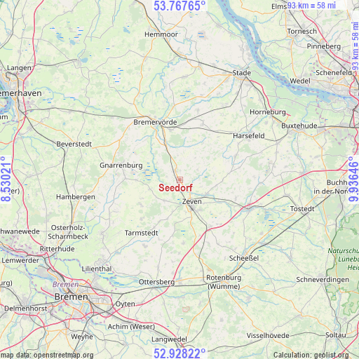
Seedorf GPS coordinates[2]
53° 21' 0" North, 9° 13' 59.988" East
| Map corner | latitude | longitude |
|---|---|---|
| Upper-left | 53.76765°, | 8.53021° |
| Center: | 53.35°, | 9.23333° |
| Lower-right: | 52.92822°, | 9.93646° |
| Map W x H: | 93.3×93.3 km | = 58×58mi |
| max Lat: | 55.01917° ⇑15.9% North |
| Seedorf: | 53.35° |
| min Lat: | ⇓84.1% South 47.40724° |
| min Long | Seedorf | max Long |
| 5.92978° | 9.23333° | 14.98853° |
| W 38.2%⇐ | ⇒61.8% E |
Elevation
Elevation of Seedorf is 32 m = 105 ft, and this is 217.1 m = 712 ft below average elevation for this country.
| Max E: |
1256 m = 4121 ft | 86.3% |
| Avg. | 249.1 m = 817 ft | |
| Seedorf | 32 m = 105 ft | |
Min E: |
-5 m = -16 ft | 13.7% |
See also: Germany elevation on elevation.city.
Geographical zone
Seedorf is located in North temperate zone (between Tropic of Cancer and the Arctic Circle). Distance of this North polar circle is 1469.2 km =912.9 mi to North.| Distance of | km | miles | from Seedorf |
|---|---|---|---|
| North Pole | 4075.1 | 2532.1 | to North |
| Arctic Circle | 1469.2 | 912.9 | to North |
| Tropic Cancer | 3326 | 2066.7 | to South |
| Equator | 5932 | 3686 | to South |


Nearby cities:
15 places around Seedorf: (largest is in red/bold)
• Anderlingen
5.4 km =3.4 mi,  59°
59°
• Breddorf
12 km =7.5 mi,  237°
237°
• Brest
14.9 km =9.3 mi,  41°
41°
• Deinstedt
7.4 km =4.6 mi,  0°
0°
• Elsdorf
14.4 km =8.9 mi,  147°
147°
• Farven
10.8 km =6.7 mi,  30°
30°
• Heeslingen
7.6 km =4.7 mi,  119°
119°
• Hepstedt
14.3 km =8.9 mi,  224°
224°
• Kirchtimke
12.4 km =7.7 mi,  206°
206°
• Ostereistedt
7.1 km =4.4 mi, 218°
• Rhade
8.3 km =5.2 mi,  253°
253°
• Sandbostel
9.5 km =5.9 mi,  313°
313°
• Selsingen
2.9 km =1.8 mi,  332°
332°
• Westertimke
14.3 km =8.9 mi, 208°
• Zeven
6.6 km =4.1 mi, 154°
Sources, notices
• [Note1] Compared only with cities in Germany existing in our database
• [Src1] Map data: © OpenStreetMap contributors (CC-BY-SA)
• [Src2] Other city data from geonames.org with taken over terms of usage.
• [Src3] Geographical zone / Annual Mean Temperature by Robert A. Rohde @ Wikipedia
