Hackenheim geodata
Hackenheim (Rheinland-Pfalz) is a seat of a fourth-order administrative division; located in Germany in Europe/Berlin (GMT+2) time zone. With population of 2,037 people, there are 5008 cities with bigger population in this country. Compared to other cities in Germany, 68.3% of cities are located further ↑North; 79% of cities are located further →East and 56.2% of cities have higher elevation than Hackenheim. Note1
Administrative division(s):
- Level 1: Rheinland-Pfalz
- Level 3: Landkreis Bad Kreuznach
- Level 4: Hackenheim


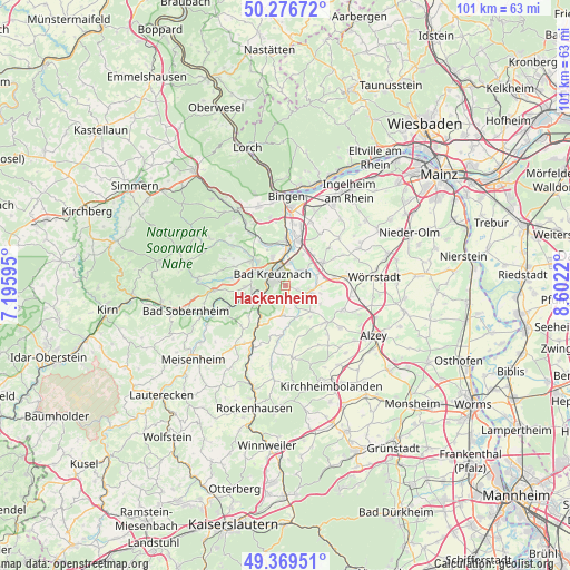
Hackenheim GPS coordinates[2]
49° 49' 30.864" North, 7° 53' 56.652" East
| Map corner | latitude | longitude |
|---|---|---|
| Upper-left | 50.27672°, | 7.19595° |
| Center: | 49.82524°, | 7.89907° |
| Lower-right: | 49.36951°, | 8.6022° |
| Map W x H: | 100.9×100.9 km | = 62.7×62.7mi |
| max Lat: | 55.01917° ⇑68.3% North |
| Hackenheim: | 49.82524° |
| min Lat: | ⇓31.7% South 47.40724° |
| min Long | Hackenheim | max Long |
| 5.92978° | 7.89907° | 14.98853° |
| W 21%⇐ | ⇒79% E |
Elevation
Elevation of Hackenheim is 180 m = 591 ft, and this is 69.1 m = 227 ft below average elevation for this country.
| Max E: |
1256 m = 4121 ft | 56.2% |
| Avg. | 249.1 m = 817 ft | |
| Hackenheim | 180 m = 591 ft | |
Min E: |
-5 m = -16 ft | 43.8% |
See also: Germany elevation on elevation.city.
Geographical zone
Hackenheim is located in North temperate zone (between Tropic of Cancer and the Arctic Circle). Distance of this North polar circle is 1861.1 km =1156.4 mi to North.| Distance of | km | miles | from Hackenheim |
|---|---|---|---|
| North Pole | 4467 | 2775.7 | to North |
| Arctic Circle | 1861.1 | 1156.4 | to North |
| Tropic Cancer | 2934.1 | 1823.2 | to South |
| Equator | 5540 | 3442.4 | to South |


Nearby cities:
15 places around Hackenheim: (largest is in red/bold)
• Bad Kreuznach
2.9 km =1.8 mi,  308°
308°
• Bad Münster am Stein-Ebernburg
4.2 km =2.6 mi,  248°
248°
• Badenheim
4.9 km =3 mi,  79°
79°
• Biebelsheim
5.2 km =3.2 mi,  28°
28°
• Bretzenheim
5.9 km =3.7 mi,  358°
358°
• Frei-Laubersheim
2.8 km =1.7 mi,  178°
178°
• Fürfeld
5.3 km =3.3 mi, 184°
• Gumbsheim
6.1 km =3.8 mi,  98°
98°
• Neu-Bamberg
3.5 km =2.2 mi,  148°
148°
• Pfaffen-Schwabenheim
4.6 km =2.9 mi,  52°
52°
• Pleitersheim
3.8 km =2.4 mi, 76°
• Siefersheim
4.6 km =2.9 mi,  127°
127°
• Traisen
6 km =3.7 mi,  260°
260°
• Volxheim
2.6 km =1.6 mi,  111°
111°
• Wöllstein
4.9 km =3 mi, 101°
Sources, notices
• [Note1] Compared only with cities in Germany existing in our database
• [Src1] Map data: © OpenStreetMap contributors (CC-BY-SA)
• [Src2] Other city data from geonames.org with taken over terms of usage.
• [Src3] Geographical zone / Annual Mean Temperature by Robert A. Rohde @ Wikipedia
