Hachenburg geodata
Hachenburg (Rheinland-Pfalz) is a populated place; located in Germany in Europe/Berlin (GMT+2) time zone. With population of 5,690 people, there are 2570 cities with bigger population in this country. Compared to other cities in Germany, 51% of cities are located further ↓South; 80.5% of cities are located further →East and 71.4% of cities have lower elevation than Hachenburg. Note1


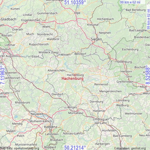
Hachenburg GPS coordinates[2]
50° 39' 35.928" North, 7° 49' 21.936" East
| Map corner | latitude | longitude |
|---|---|---|
| Upper-left | 51.10359°, | 7.11963° |
| Center: | 50.65998°, | 7.82276° |
| Lower-right: | 50.21214°, | 8.52588° |
| Map W x H: | 99.1×99.1 km | = 61.6×61.6mi |
| max Lat: | 55.01917° ⇑49% North |
| Hachenburg: | 50.65998° |
| min Lat: | ⇓51% South 47.40724° |
| min Long | Hachenburg | max Long |
| 5.92978° | 7.82276° | 14.98853° |
| W 19.5%⇐ | ⇒80.5% E |
Elevation
Elevation of Hachenburg is 369 m = 1211 ft, and this is 119.9 m = 393 ft above average elevation for this country.
| Max E: |
1256 m = 4121 ft | 28.6% |
| Hachenburg | 369 m 1211 ft | |
| Avg. | 249.1 m = 817 ft | |
Min E: |
-5 m = -16 ft | 71.4% |
See also: Germany elevation on elevation.city.
Geographical zone
Hachenburg is located in North temperate zone (between Tropic of Cancer and the Arctic Circle). Distance of this North polar circle is 1768.3 km =1098.8 mi to North.| Distance of | km | miles | from Hachenburg |
|---|---|---|---|
| North Pole | 4374.2 | 2718 | to North |
| Arctic Circle | 1768.3 | 1098.8 | to North |
| Tropic Cancer | 3026.9 | 1880.8 | to South |
| Equator | 5632.9 | 3500.1 | to South |


Nearby cities:
15 places around Hachenburg: (largest is in red/bold)
• Alpenrod
4.3 km =2.7 mi,  133°
133°
• Astert
5 km =3.1 mi,  321°
321°
• Atzelgift
4.5 km =2.8 mi,  9°
9°
• Gehlert
2.1 km =1.3 mi,  166°
166°
• Hattert
4 km =2.5 mi,  280°
280°
• Limbach
4.7 km =2.9 mi,  340°
340°
• Luckenbach
4.5 km =2.8 mi, 9°
• Merkelbach
4.1 km =2.5 mi,  246°
246°
• Müschenbach
3.8 km =2.4 mi,  313°
313°
• Nauroth
5.7 km =3.5 mi,  40°
40°
• Nister
2.1 km =1.3 mi,  31°
31°
• Norken
5.5 km =3.4 mi,  74°
74°
• Steinebach
5.7 km =3.5 mi,  191°
191°
• Streithausen
3.8 km =2.4 mi,  351°
351°
• Wied
5.2 km =3.2 mi,  243°
243°
Sources, notices
• [Note1] Compared only with cities in Germany existing in our database
• [Src1] Map data: © OpenStreetMap contributors (CC-BY-SA)
• [Src2] Other city data from geonames.org with taken over terms of usage.
• [Src3] Geographical zone / Annual Mean Temperature by Robert A. Rohde @ Wikipedia
