Gutow geodata
Gutow (Mecklenburg-Vorpommern) is a populated place; located in Germany in Europe/Berlin (GMT+2) time zone. With population of 734 people, there are 8174 cities with bigger population in this country. Compared to other cities in Germany, 89.5% of cities are located further ↓South; 83.7% of cities are located further ←West and 90.1% of cities have higher elevation than Gutow. Note1
Administrative division(s):
- Level 1: Mecklenburg-Vorpommern
- Level 3: Landkreis Rostock
- Level 4: Gutow


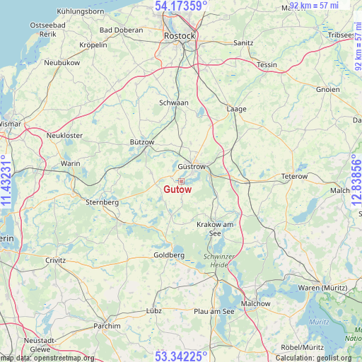
Gutow GPS coordinates[2]
53° 45' 35.928" North, 12° 8' 7.548" East
| Map corner | latitude | longitude |
|---|---|---|
| Upper-left | 54.17359°, | 11.43231° |
| Center: | 53.75998°, | 12.13543° |
| Lower-right: | 53.34225°, | 12.83856° |
| Map W x H: | 92.4×92.4 km | = 57.4×57.4mi |
| max Lat: | 55.01917° ⇑10.5% North |
| Gutow: | 53.75998° |
| min Lat: | ⇓89.5% South 47.40724° |
| min Long | Gutow | max Long |
| 5.92978° | 12.13543° | 14.98853° |
| W 83.7%⇐ | ⇒16.3% E |
Elevation
Elevation of Gutow is 21 m = 69 ft, and this is 228.1 m = 748 ft below average elevation for this country.
| Max E: |
1256 m = 4121 ft | 90.1% |
| Avg. | 249.1 m = 817 ft | |
| Gutow | 21 m = 69 ft | |
Min E: |
-5 m = -16 ft | 9.9% |
See also: Germany elevation on elevation.city.
Geographical zone
Gutow is located in North temperate zone (between Tropic of Cancer and the Arctic Circle). Distance of this North polar circle is 1423.6 km =884.6 mi to North.| Distance of | km | miles | from Gutow |
|---|---|---|---|
| North Pole | 4029.5 | 2503.8 | to North |
| Arctic Circle | 1423.6 | 884.6 | to North |
| Tropic Cancer | 3371.6 | 2095 | to South |
| Equator | 5977.5 | 3714.2 | to South |


Nearby cities:
15 places around Gutow: (largest is in red/bold)
• Gülzow
8 km =5 mi,  326°
326°
• Güstrow
4.8 km =3 mi,  31°
31°
• Hoppenrade
9.7 km =6 mi,  111°
111°
• Lohmen
9 km =5.6 mi,  197°
197°
• Lüdershagen
9.5 km =5.9 mi,  118°
118°
• Lüssow
8.7 km =5.4 mi,  3°
3°
• Mistorf
13.9 km =8.6 mi, 2°
• Mustin
12.9 km =8 mi,  236°
236°
• Mühl Rosin
5.2 km =3.2 mi,  85°
85°
• Prüzen
6.7 km =4.2 mi,  265°
265°
• Reimershagen
10.1 km =6.3 mi,  164°
164°
• Sarmstorf
10.3 km =6.4 mi, 27°
• Tarnow
8 km =5 mi,  285°
285°
• Zehna
4.9 km =3 mi,  177°
177°
• Zepelin
10.2 km =6.3 mi,  324°
324°
Sources, notices
• [Note1] Compared only with cities in Germany existing in our database
• [Src1] Map data: © OpenStreetMap contributors (CC-BY-SA)
• [Src2] Other city data from geonames.org with taken over terms of usage.
• [Src3] Geographical zone / Annual Mean Temperature by Robert A. Rohde @ Wikipedia
