Günzburg geodata
Günzburg (Bavaria) is a seat of a third-order administrative division; located in Germany in Europe/Berlin (GMT+2) time zone. With population of 19,737 people, there are 789 cities with bigger population in this country. Compared to other cities in Germany, 89.6% of cities are located further ↑North; 54.8% of cities are located further ←West and 85.1% of cities have lower elevation than Günzburg. Note1
Administrative division(s):
- Level 1: Bavaria
- Level 2: Swabia
- Level 3: Landkreis Günzburg
- Level 4: Günzburg


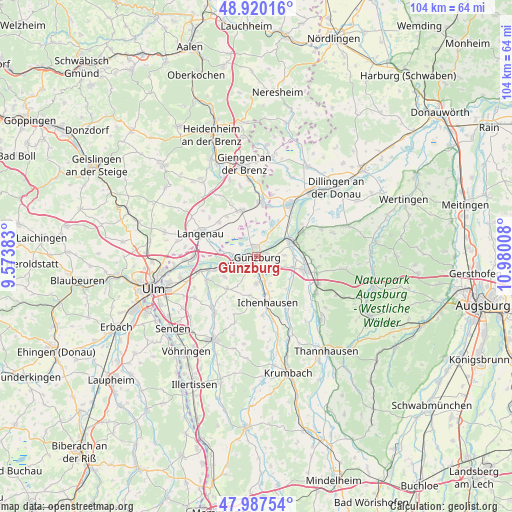
Günzburg GPS coordinates[2]
48° 27' 21.564" North, 10° 16' 37.02" East
| Map corner | latitude | longitude |
|---|---|---|
| Upper-left | 48.92016°, | 9.57383° |
| Center: | 48.45599°, | 10.27695° |
| Lower-right: | 47.98754°, | 10.98008° |
| Map W x H: | 103.7×103.7 km | = 64.4×64.4mi |
| max Lat: | 55.01917° ⇑89.6% North |
| Günzburg: | 48.45599° |
| min Lat: | ⇓10.4% South 47.40724° |
| min Long | Günzburg | max Long |
| 5.92978° | 10.27695° | 14.98853° |
| W 54.8%⇐ | ⇒45.2% E |
Elevation
Elevation of Günzburg is 470 m = 1542 ft, and this is 220.9 m = 725 ft above average elevation for this country.
| Max E: |
1256 m = 4121 ft | 14.9% |
| Günzburg | 470 m 1542 ft | |
| Avg. | 249.1 m = 817 ft | |
Min E: |
-5 m = -16 ft | 85.1% |
See also: Germany elevation on elevation.city.
Geographical zone
Günzburg is located in North temperate zone (between Tropic of Cancer and the Arctic Circle). Distance of this North polar circle is 2013.4 km =1251.1 mi to North.| Distance of | km | miles | from Günzburg |
|---|---|---|---|
| North Pole | 4619.3 | 2870.3 | to North |
| Arctic Circle | 2013.4 | 1251.1 | to North |
| Tropic Cancer | 2781.9 | 1728.6 | to South |
| Equator | 5387.8 | 3347.8 | to South |


Nearby cities:
15 places around Günzburg: (largest is in red/bold)
• Asselfingen
10.3 km =6.4 mi,  322°
322°
• Bubesheim
3.2 km =2 mi,  218°
218°
• Burgau
10.2 km =6.3 mi,  105°
105°
• Bächingen an der Brenz
10.4 km =6.5 mi,  14°
14°
• Dürrlauingen
11.2 km =7 mi,  83°
83°
• Gundremmingen
10.3 km =6.4 mi,  61°
61°
• Ichenhausen
9.7 km =6 mi,  166°
166°
• Leipheim
4 km =2.5 mi,  260°
260°
• Niederstotzingen
10 km =6.2 mi,  341°
341°
• Offingen
7 km =4.3 mi, 64°
• Rammingen
10.4 km =6.5 mi,  311°
311°
• Rettenbach
5.6 km =3.5 mi,  86°
86°
• Rieden an der Kötz
8 km =5 mi,  190°
190°
• Sontheim an der Brenz
10.8 km =6.7 mi, 5°
• Wasserburg
1.8 km =1.1 mi,  198°
198°
In other languages:
- In Spanish: Gunzburgo
- In France: Guntzbourg
- In Russian: Гюнцбург
- In Chinese: 金茨堡
Sources, notices
• [Note1] Compared only with cities in Germany existing in our database
• [Src1] Map data: © OpenStreetMap contributors (CC-BY-SA)
• [Src2] Other city data from geonames.org with taken over terms of usage.
• [Src3] Geographical zone / Annual Mean Temperature by Robert A. Rohde @ Wikipedia
