Groß-Rohrheim geodata
Groß-Rohrheim (Hesse) is a seat of a fourth-order administrative division; located in Germany in Europe/Berlin (GMT+2) time zone. With population of 3,822 people, there are 3393 cities with bigger population in this country. Compared to other cities in Germany, 70.8% of cities are located further ↑North; 71.3% of cities are located further →East and 70% of cities have higher elevation than Groß-Rohrheim. Note1
Administrative division(s):
- Level 1: Hesse
- Level 2: Regierungsbezirk Darmstadt
- Level 3: Landkreis Bergstraße
- Level 4: Groß-Rohrheim


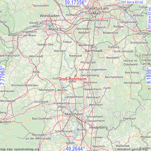
Groß-Rohrheim GPS coordinates[2]
49° 43' 15.996" North, 8° 28' 58.008" East
| Map corner | latitude | longitude |
|---|---|---|
| Upper-left | 50.17356°, | 7.77965° |
| Center: | 49.72111°, | 8.48278° |
| Lower-right: | 49.2644°, | 9.1859° |
| Map W x H: | 101.1×101.1 km | = 62.8×62.8mi |
| max Lat: | 55.01917° ⇑70.8% North |
| Groß-Rohrheim: | 49.72111° |
| min Lat: | ⇓29.2% South 47.40724° |
| min Long | Groß-Rohrheim | max Long |
| 5.92978° | 8.48278° | 14.98853° |
| W 28.7%⇐ | ⇒71.3% E |
Elevation
Elevation of Groß-Rohrheim is 91 m = 299 ft, and this is 158.1 m = 519 ft below average elevation for this country.
| Max E: |
1256 m = 4121 ft | 70% |
| Avg. | 249.1 m = 817 ft | |
| Groß-Rohrheim | 91 m = 299 ft | |
Min E: |
-5 m = -16 ft | 30% |
See also: Germany elevation on elevation.city.
Geographical zone
Groß-Rohrheim is located in North temperate zone (between Tropic of Cancer and the Arctic Circle). Distance of this North polar circle is 1872.7 km =1163.6 mi to North.| Distance of | km | miles | from Groß-Rohrheim |
|---|---|---|---|
| North Pole | 4478.6 | 2782.9 | to North |
| Arctic Circle | 1872.7 | 1163.6 | to North |
| Tropic Cancer | 2922.6 | 1816 | to South |
| Equator | 5528.5 | 3435.2 | to South |


Nearby cities:
15 places around Groß-Rohrheim: (largest is in red/bold)
• Alsbach-Hähnlein
8.4 km =5.2 mi,  76°
76°
• Alsheim
11.5 km =7.1 mi,  297°
297°
• Bensheim
10.6 km =6.6 mi,  113°
113°
• Biblis
3.7 km =2.3 mi,  207°
207°
• Bickenbach
10.6 km =6.6 mi,  66°
66°
• Biebesheim
6.7 km =4.2 mi,  350°
350°
• Bürstadt
8.9 km =5.5 mi,  190°
190°
• Eich
6.8 km =4.2 mi, 298°
• Einhausen
6.8 km =4.2 mi,  136°
136°
• Gernsheim
3.6 km =2.2 mi,  6°
6°
• Gimbsheim
10 km =6.2 mi,  309°
309°
• Lorsch
9.9 km =6.2 mi, 142°
• Mettenheim
11.5 km =7.1 mi,  280°
280°
• Stockstadt am Rhein
9.8 km =6.1 mi,  355°
355°
• Zwingenberg
9.2 km =5.7 mi,  88°
88°
Sources, notices
• [Note1] Compared only with cities in Germany existing in our database
• [Src1] Map data: © OpenStreetMap contributors (CC-BY-SA)
• [Src2] Other city data from geonames.org with taken over terms of usage.
• [Src3] Geographical zone / Annual Mean Temperature by Robert A. Rohde @ Wikipedia
